Other ID: none
Status: Cancelled
Organization(s): USGS, Woods Hole Coastal and Marine Science Center, National Oceanic and Atmospheric Administration, USGS, Wetland and Aquatic Research Center
Funding Program(s): Other (Other)
Principal Investigator(s): Jason Chaytor
Affiliate Investigator(s): Amanda Demopoulos, WARC
Information Specialist(s): Brian Andrews
Data Type(s): Environmental Data: CTD, Imagery: Photo, Seismics: Sub Bottom Profiler, Sonar: Multibeam, Sonar: Sidescan
Scientific Purpose/Goals: High resolution mapping and photographic imaging of past nodule extraction activities
Vehicle(s):
Start Port/Location: Charleston, SC
End Port/Location: Charleston, SC
Start Date: 2021-07-24
End Date: 2021-08-06
Equipment Used: Other, Digital camera, Other, Other
Information to be Derived: Seafloor morphology, sub-bottom structure, benthic environmental characterization
Summary of Activity and Data Gathered:
Staff: Jason Chaytor
Affiliate Staff:
Notes: canceled by VAC based on email from Jason Chaytor
Location:
Blake Plateau
| Boundaries | |||
|---|---|---|---|
| North: 32.62272037 | South: 30.95605371 | West: -78.4753418 | East: -76.80867513 |
Platform(s):
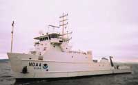 Nancy Foster |
| Survey Equipment | Survey Info | Data Type(s) | Data Collected |
|---|---|---|---|
| Other | --- | --- | --- |
| Digital camera | --- | Photo | |
| Other | --- | --- | --- |
| Other | --- | --- | --- |
