Other ID: none
Status: Pending
Organization(s): USGS, Woods Hole Coastal and Marine Science Center, Woods Hole Oceanographic Institution
Funding Program(s): CMHRP Program Office Operational Costs (GY00ET2SZ00)
Principal Investigator(s): Nathaniel Miller
Affiliate Investigator(s): Pablo Canales (WHOI)
Information Specialist(s): Nathaniel Miller
Data Type(s): Seismics: Ocean Bottom Seismometer
Scientific Purpose/Goals: Active-source ocean bottom seismic imaging and velocity measurements for forearc structure and physical properties
Vehicle(s):
Start Port/Location: Newport, OR
End Port/Location: Newport, OR
Start Date: 2021-05-24
End Date: 2021-05-28
Equipment Used: Ocean Bottom Seismometer
Information to be Derived: Seismic Vp and Vs
Summary of Activity and Data Gathered: 60 ocean bottom seismometers were deployed offshore of coastal Oregon at predetermined locations along six roughly shore-normal transects in preparation for recording shots from a multichannel seismic survey planned for the same transects on a subsequent leg.
Staff: Wayne Baldwin, Nathaniel Miller
Affiliate Staff:
Notes: Funding account is GX20GY00ET2SZ00
Two-week quarantine required prior to sailing. Quarantine 5/7 - 5/21
Location:
Cascadia
| Boundaries | |||
|---|---|---|---|
| North: 51.7814356 | South: 39.50404065 | West: -132.97851563 | East: -122.25585938 |
Platform(s):
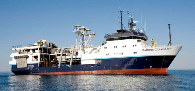 Marcus G. Langseth |
| Survey Equipment | Survey Info | Data Type(s) | Data Collected |
|---|---|---|---|
| Ocean Bottom Seismometer | Deployment - the data will be associated with the related field activity 2021-009-FA. | Ocean Bottom Seismometer | No data was collected |
