Other ID: none
Status: Completed
Organization(s): USGS, Woods Hole Coastal and Marine Science Center
Funding Program(s): Massachusetts Integrated Coastal Studies (LQ00M0Z)
Principal Investigator(s): John Warner
Affiliate Investigator(s):
Information Specialist(s): Steven Suttles
Data Type(s): Sampling: Geology, Time Series: Mooring (physical oceanography)
Scientific Purpose/Goals: Collect data to assess cross-shore sediment transport prediction techniques being implemented in coastal modeling efforts for wave dominated sandy coast. Measurements will focus on waves, wave induced water velocities near the seabed, and the response of the seabed to these forces.
Vehicle(s):
Start Port/Location: WHOI Dock, Woods Hole, MA
End Port/Location: WHOI Dock, Woods Hole, MA
Start Date: 2021-03-10
End Date: 2021-03-10
Equipment Used: Grab sampler, Bottom platform
Information to be Derived: waves, currents, water level, seabed images (sonar), seabed changes, suspended sediment, water temperature, conductivity, grain size of bottom sediment.
Summary of Activity and Data Gathered: Arrived on site @ 14:40 UTC. Only 3 samples collected by ponar because the sampler came up empty on the other 3 tries. Quadpod in the water @ 15:58. Communicated with the releases and verified they were upright.
Staff: Robert Bales, Alexander Olson, Steven Suttles, John Warner
Affiliate Staff:
Notes:
Location:
Sandy Neck Beach, Cape Cod Bay, Barnstable, Massachusetts, United States, Atlantic Ocean
| Boundaries | |||
|---|---|---|---|
| North: 41.7891 | South: 41.7112 | West: -70.3665 | East: -70.2557 |
Platform(s):
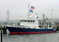
 Tioga |
De Meo, O.A., Bales, R.D., Suttles, S.E., and Warner, J.C., 2024, Grain-size analysis data from sediment samples in support of oceanographic and water-quality measurements in the nearshore zone of Sandy Neck Beach, Cape Cod Bay, Massachusetts, collected in March and April, 2021: U.S. Geological Survey data release, https://doi.org/10.5066/P13AJGXV.
Suttles, S.E., De Meo, O.A., Bales, R.D., and Warner, J.C., 2025, Time-series measurements of oceanographic and seabed response data collected in Cape Cod Bay, Barnstable, MA, March 10 to April 7, 2021: U.S. Geological Survey data release, https://doi.org/10.5066/P19NUBNW.
| Survey Equipment | Survey Info | Data Type(s) | Data Collected |
|---|---|---|---|
| Grab sampler | --- | Biology Geology | |
| Bottom platform | --- | Mooring (physical oceanography) |