Other ID: MRDF
Status: Cancelled
Organization(s): USGS, Woods Hole Coastal and Marine Science Center
Funding Program(s): Marine Geohazards Sources and Probability (LQ00ENR)
Principal Investigator(s): Jason Chaytor
Affiliate Investigator(s): BOEM
Information Specialist(s): Brian Andrews, Wayne Baldwin
Data Type(s): Sampling: Geology, Sonar: Multibeam, Seismics: Sparker, Seismics: Boomer
Scientific Purpose/Goals: Geophysical mapping of the Mississippi Delta River Front
Vehicle(s):
Start Port/Location: Cocodrie, LA
End Port/Location: Cocodrie, LA
Start Date: 2021-09-26
End Date: 2021-10-09
Equipment Used: Reson T20-P, Sparker , S-Boom seismic source
Information to be Derived: Bathymetry, sub-bottom, backscatter, testing of multicorer
Summary of Activity and Data Gathered:
Staff: David Foster, Charles Worley, Alexander Nichols, Eric Moore, Wayne Baldwin
Affiliate Staff:
Notes: Staffing is TBD. There will be at least 7 staff as well as Jason (PI).
The multicorer (new system) may be tested but that is yet to be determined.
Location:
Mississippi River Delta Front, Gulf of Mexico
| Boundaries | |||
|---|---|---|---|
| North: 30.24008607 | South: 26.6474587 | West: -93.39843761 | East: -85.94238237 |
Platform(s):
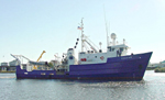 Pelican |
| Survey Equipment | Survey Info | Data Type(s) | Data Collected |
|---|---|---|---|
| Reson T20-P | --- | Multibeam Water column reflectivity | |
| Sparker | --- | Sparker | |
| S-Boom seismic source | --- | Boomer |
