Other ID: none
Status: Completed
Organization(s): USGS, St. Petersburg Coastal and Marine Science Center
Funding Program(s): Coastal Sediment Availability and Flux - CSAF (GX.26.MN00.M0Y60.00)
Principal Investigator(s): Jennifer Miselis
Affiliate Investigator(s): Ian Conery, USACE
Information Specialist(s): Arnell Forde, Nancy DeWitt, Andrew Farmer
Data Type(s): Location-Elevation: Navigation, Seismics: Sub Bottom Profiler, Sonar: Single Beam
Scientific Purpose/Goals: To measure the coevolution of the morphology and geology of the shoreface before and after a storm and during recovery.
Vehicle(s): Ford F-350 Dually White (GSA)
Start Port/Location: Duck, NC
End Port/Location: Duck, NC
Start Date: 2021-06-14
End Date: 2021-06-23
Equipment Used: Global Positioning System (GPS), Chirp 512i, ODOM-Echotrac CV-100
Information to be Derived: Sub-seafloor geology, shoreface profile morphology
Summary of Activity and Data Gathered: Collected 44 sub-bottom profiles (SBP), 25 single-beam bathymetry lines, and 9 sound velocity profiles (SVP).
Staff: Andrew Farmer, Jennifer Miselis
Affiliate Staff:
Notes: Second seismic survey occurred December 3-10, 2021.
Location:
USACE Field Research Facility, Duck, NC, Atlantic Ocean
| Boundaries | |||
|---|---|---|---|
| North: 36.1897445 | South: 36.18115225 | West: -75.75854301 | East: -75.73851597 |
Platform(s):
Other | 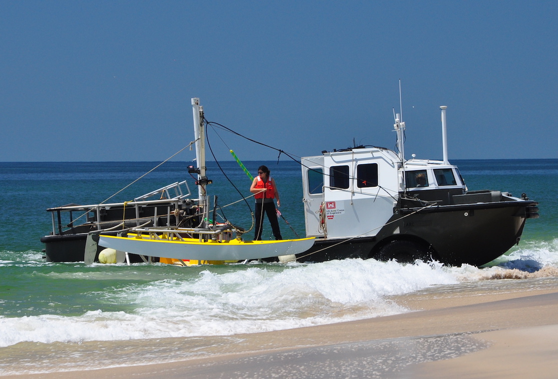 USACE LARC-5 |
Forde, A.S., Miselis, J.L., Conery, I., DeWitt, N.T., Buster, N.A., 2024, Chirp Sub-Bottom Profile Geophysical Data Collected in 2021 and 2022 From Duck, North Carolina: U.S. Geological Survey data release, https://doi.org/10.5066/P1346BEP.
Over, J.R., Sherwood, C.R., Hegermiller, C.A., 2021, USGS DUNEX Operations on the Outer Banks: URL: https://www.usgs.gov/centers/woods-hole-coastal-and-marine-science-center/science/usgs-dunex-operations-outer-banks.
| Survey Equipment | Survey Info | Data Type(s) | Data Collected |
|---|---|---|---|
| Global Positioning System (GPS) | --- | Navigation | |
| Chirp 512i | --- | Sub Bottom Profiler | |
| ODOM-Echotrac CV-100 | --- | Single Beam | No data was collected |
