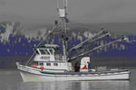
AKA: Kodiak Island Uyak Bay paleoseismology
Other ID: none
Status: Completed
Organization(s): USGS, Pacific Coastal and Marine Science Center, USGS, Alaska Science Center
Funding Program(s): Coastal and marine earthquake, tsunami, and landslide active margin field studies (ZP00EQV)
Principal Investigator(s): Drake Singleton, Jenna Hill, Daniel Brothers
Affiliate Investigator(s): Peter Haeussler (USGS ASC), Rob Witter (USGS ASC)
Information Specialist(s): Drake Singleton, Alicia Balster-gee
Data Type(s): Seismics: Sub Bottom Profiler
Scientific Purpose/Goals: Determine the paleoseismic history along the Kodiak section of the Aleutian megathrust.
Vehicle(s): None
Start Port/Location: Homer, AK
End Port/Location: Home, AK
Start Date: 2021-08-02
End Date: 2021-08-22
Equipment Used: Other
Information to be Derived: stratigraphic framework, grain size, age control
Summary of Activity and Data Gathered: Collected high-resolution Chrip dataset of Uyak Bay as well as short-barrel gravity cores. Target of field activity was sedimentary signal of large megathrust earthquakes beneath Kodiak Island.
Staff:
Affiliate Staff:
Notes: Drake Singleton is the point of contact for this operation
Location:
Kodiak Island, Alaska
| Boundaries | |||
|---|---|---|---|
| North: 58.22055094 | South: 56.44318565 | West: -154.93649483 | East: -151.58841133 |
Platform(s):
 Alaskan Gyre |
| Survey Equipment | Survey Info | Data Type(s) | Data Collected |
|---|---|---|---|
| Other | --- | --- | --- |