AKA: Palos Verdes Fault 2021 (USGS/BOEM)
Other ID: none
Status: Completed
Organization(s): USGS, Pacific Coastal and Marine Science Center
Funding Program(s): Other (Other), Coastal and marine earthquake, tsunami, and landslide active margin field studies (ZP00EQV)
Principal Investigator(s): Jared Kluesner, James Conrad, Daniel Brothers
Affiliate Investigator(s): Travis Alongi (UCSC), Mark Leung (BOEM)
Information Specialist(s): Alicia Balster-gee
Data Type(s): Seismics: Sub Bottom Profiler, Seismics: Sparker, Seismics: Multichannel
Scientific Purpose/Goals: acquire seismic imaging of the Palos Verdes Fault zone to quantify damage zone characteristics and seismic hazards
Vehicle(s): Dodge Caravan - G41-2395R, MarFac; Ford 650 Box truck - White G71-03559, MarFac; Ford F350 pickup/stake truck; 6 pass; G82-0317H, Sonata Hybrid G10-6192P
Start Port/Location: San Diego, CA
End Port/Location: San Diego, CA
Start Date: 2021-05-07
End Date: 2021-05-26
Equipment Used: minisparker, Mini sparker, 0.5-16 kHz receiver, 0.5-16 kHz, Multichannel, multichannel source
Information to be Derived: stratigraphic framework, fault/fracture distribution, sequence strat, fluid flow evidence
Summary of Activity and Data Gathered: Collection of Sparker MCS and CHIRP profiles across the Palos Verdes Fault Zone.
Staff: Rachel Marcuson, Robert Wyland
Affiliate Staff:
Notes: There will be 8 days at sea.
Location:
San Pedro Shelf and Slope offshore Los Angeles
| Boundaries | |||
|---|---|---|---|
| North: 33.89364486 | South: 33.37643027 | West: -118.54136467 | East: -117.84641504 |
Platform(s):
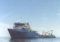
 Robert Gordon Sproul |
Alongi, T., Balster-Gee, A.F. Kluesner, J.W., Snyder, G.R., Brothers, D.S., Conrad, J.E., and Marcuson, R.K., 2024, Multichannel minisparker and chirp seismic reflection data collected during USGS field activity 2021-614-FA along the Palos Verdes Fault Zone: U.S. Geological Survey data release, https://doi.org/10.5066/P9HCOSDF.
| Survey Equipment | Survey Info | Data Type(s) | Data Collected |
|---|---|---|---|
| minisparker | --- | Sparker | |
| Mini sparker | --- | Sparker | |
| 0.5-16 kHz receiver | --- | Sub Bottom Profiler | Chirp sub-bottom data collected during USGS field activity 2021-614-FA along the Palos Verdes Fault Zone (Chirp sub-bottom data were collected by the U.S. Geological Survey in May of 2021 along the Palos Verdes Fault Zone in San Pedro Bay and San Pedro Channel. MCS data were acquired coincident with chirp sub-bottom data.) |
| 0.5-16 kHz | --- | Sub Bottom Profiler | |
| Multichannel | --- | Multichannel | Multichannel minisparker seismic reflection data collected during USGS field activity 2021-614-FA along the Palos Verdes Fault Zone (High-resolution multichannel minisparker seismic reflection (MCS) data were collected by the U.S. Geological Survey in May of 2021 along the Palos Verdes Fault Zone in San Pedro Bay and San Pedro Channel. MCS data were acquired coincident with chirp sub-bottom data.) |
| multichannel source | --- | Multichannel |