AKA: none
Other ID: none
Status: Completed
Organization(s): Other, USGS, Pacific Coastal and Marine Science Center, Western Washington University, National Science Foundation
Funding Program(s): Coastal and marine earthquake, tsunami, and landslide active margin field studies (ZP00EQV)
Principal Investigator(s): Maureen Walton
Affiliate Investigator(s): Emily Roland (Western Washington University) Lindsay Worthington (University of New Mexico) Mladen Nedimovic (Dalhousie University)
Information Specialist(s): Maureen Walton
Data Type(s): Sonar: Single Beam, Seismics: Ocean Bottom Seismometer
Scientific Purpose/Goals: To better understand geologic structure and earthquake hazards along the Queen Charlotte fault system.
Vehicle(s): None
Start Port/Location: Port Angeles, Washington, USA
End Port/Location: Prince Rupert, British Columbia, Canada
Start Date: 2021-07-17
End Date: 2021-08-12
Equipment Used: 12khz, seismograph, Other
Information to be Derived: Seismic refraction, subsurface seismic velocity data, water depth
Summary of Activity and Data Gathered: Ocean bottom seismometers were deployed and retrieved after being shot to by a second ship, the R/V Langseth. 12 kHz sonar was used to detect water depth and instrument locations local to deployment areas.
Staff: Maureen Walton
Affiliate Staff:
Notes:
Location:
offshore, southeastern Alaska, Alaska, United States, western British Columbia, British Columbia, Haida Gwaii, Canada
| Boundaries | |||
|---|---|---|---|
| North: 57.13623932 | South: 51.51002454 | West: -138.07273865 | East: -128.86997223 |
Platform(s):
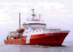 John P Tully |
| Survey Equipment | Survey Info | Data Type(s) | Data Collected |
|---|---|---|---|
| 12khz | --- | Single Beam | |
| seismograph | --- | Ocean Bottom Seismometer | |
| Other | --- | --- | --- |
