Other ID: none
Status: Pending
Organization(s): USGS, Woods Hole Coastal and Marine Science Center
Funding Program(s): Massachusetts Integrated Coastal Studies (LQ00M0Z)
Principal Investigator(s): Laura Brothers
Affiliate Investigator(s):
Information Specialist(s): Brian Andrews
Data Type(s): Sonar: Sound Velocity, Seismics: Sub Bottom Profiler, Sonar: Multibeam
Scientific Purpose/Goals: Collect seafloor and subseafloor information aid the State, and coastal vulnerability studies
Vehicle(s):
Start Port/Location: Mashpee, MA
End Port/Location: Mashpee, MA
Start Date: 2022-06-03
End Date: 2022-06-24
Equipment Used: AML-3 LGR, AML Minos X, Reson T20-P, Edgetech 3400
Information to be Derived: seafloor mapping data including geophysical and seafloor sampling data
Summary of Activity and Data Gathered: Collected ~ 680 linear kms of Edgetech 3400 and dual-head Reson T20-P data during 13 days between June 3 and 24th. Original survey plan was adjusted due to R/V Rafael engine challenges. Survey was divided into two areas based on overall depth. South (deep) survey area used tracklines 87 meters apart and was completed in 8 days. The north (shallow) area used trackline spacing of 52 meters and was 30% complete before the end of the survey on June 24th.
Staff: Seth Ackerman, Eric Moore, William Danforth, Alexander Nichols, Charles Worley, David Foster, Wayne Baldwin, Brian Andrews
Affiliate Staff:
Notes:
Location:
Nantucket Sound
| Boundaries | |||
|---|---|---|---|
| North: 41.576575 | South: 41.492948 | West: -70.488445 | East: -70.268969 |
Platform(s):
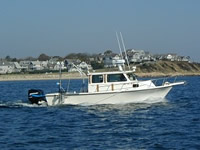
 Rafael |
Andrews, B.D., Baldwin, W.E., Worley, C.R., Moore, E.M., Nichols, A.R., Danforth, W.W., Foster, D.S., Ackerman, S.D., and Brothers, L.L. 2023, High-resolution geophysical data collected in Nantucket Sound Massachusetts in the vicinity of Horseshoe Shoal, during USGS Field Activity 2022-001-FA: U.S. Geological Survey data release, https://doi.org/10.5066/P9O5G5OT.
| Survey Equipment | Survey Info | Data Type(s) | Data Collected |
|---|---|---|---|
| AML-3 LGR | --- | Sound Velocity | |
| AML Minos X | --- | Sound Velocity | |
| Reson T20-P | --- | Multibeam Water column reflectivity | 2022-001-FA_TeledyneSeaBat_T20P_Bathymetry_2m (Multibeam bathymetric data collected in Nantucket Sound Massachusetts in the vicinity of Horseshoe Shoal, during USGS Field Activity 2022-001-FA using a Teledyne SeaBat Integrated Dual-Head (IDH) T20-P multibeam echosounder (32-bit GeoTIFF, UTM Zone 19N, NAD 83, MLLW Datum, 2-m resolution)) 2022-001-FA_TeledyneSeaBat_T20P_Tracklines (Trackline navigation data collected in Nantucket Sound Massachusetts in the vicinity of Horseshoe Shoal, during USGS Field Activity 2022-001-FA using a Teledyne SeaBat Integrated Dual-Head (IDH) T20-P multibeam echosounder (Esri polyline shapefile, Geographic, WGS 84)) 2022-001-FA_TeledyneT20P_Backscatter_1m (Multibeam backscatter data collected in Nantucket Sound Massachusetts in the vicinity of Horseshoe Shoal, during USGS Field Activity 2022-001-FA using a Teledyne SeaBat Integrated Dual-Head (IDH) T20-P multibeam echosounder (8-bit GeoTIFF, UTM Zone 19N, WGS 84, 1-m resolution)) |
| Edgetech 3400 | --- | Sub Bottom Profiler | 2022-001-FA_ET3400 (Chirp seismic reflection data- shotpoints, tracklines, profile images, and SEG-Y traces for EdgeTech 3400 chirp data collected during USGS field activity 2022-001-FA (point and polyline shapefiles, CSV text, PNG Images (1 GB), and SEG-Y data (13 GB), GCS WGS 84)) |