Other ID: HRS2202
Status: Pending
Organization(s): USGS, Woods Hole Coastal and Marine Science Center
Funding Program(s): Other (Other)
Principal Investigator(s): Jason Chaytor
Affiliate Investigator(s): University of Texas, Applied Research Lab US Naval Research Laboratory
Information Specialist(s): Brian Buczkowski
Data Type(s): Seismics: Sub Bottom Profiler, Sampling: Biology, Sampling: Geology
Scientific Purpose/Goals: The objective of this coring cruise is to continue the investigation of the shallow stratigraphy of the New England Mud Patch, another small shelf basin south of the main Mud Patch study area, and an area along the shelf-edge between Block and Alvin canyons.
Vehicle(s):
Start Port/Location: Lewes, DE
End Port/Location: Woods Hole, MA
Start Date: 2022-03-22
End Date: 2022-04-15
Equipment Used: Edgetech chirp subbottom profiler 512i, Sample containers, Gravity corer, Piston corer
Information to be Derived: Grain size, mineralogy, physical properties, chirp sub-bottom profiler data
Summary of Activity and Data Gathered: Poor weather resulted in several delays throughout the field activity. Upon completion of the cruise, 29 piston cores and 24 trigger cores measuring 130.2 meters of sediment were recovered and logged using the ship-board MSCL. Any cores that were not logged at sea were logged on land using the same MSCL and van on the Quissett Campus. Seismic data collection data and information will be entered as soon as it becomes available.
Staff: Daniel Powers, Peter Dal Ferro, William Danforth, Charles Worley, Brian Buczkowski, Allyson Boggess, Wayne Baldwin
Affiliate Staff:
Sam Griffith
US Naval Research Laboratory
Justin Tran
US Naval Research Laboratory
Giancarlo Restreppo
US Naval Research Laboratory
Notes: Piston and gravity coring, chirp data
Location:
NE Mud Patch, Southern New England Shelf edge
| Boundaries | |||
|---|---|---|---|
| North: 40.78054143 | South: 39.436193 | West: -71.32324219 | East: -68.81835938 |
Platform(s):
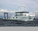 Hugh R. Sharp |
Ballard, M.S., Garcia, D.D., Lee, K.M., Venegas, G.R., McNeese, A.R., Wilson, P.R., and Chaytor, J.D., 2024, Direct measurements of sediment geoacoustic properties in the New England Mud Patch and shelf break: J. Acoust. Soc. Am., 156 (4), 2889-2902, https://doi.org/10.1121/10.0032469.
DeCourcy, B., Lin, Y.T., Chaytor, J., 2024, Effects of seabed corrugation and stratification on 3D acoustic propagation along the New England Shelf Break: , 186th Meeting of the Acoustical Society of America.
Holland, C.W., Dosso, S.E., Chaytor, J.D., 2024, Mud Acoustics: Acoustics Today, 20(1), 37-45, https://doi.org/10.1121/AT.2024.20.1.37.
Knobles, D.P., Hodgkiss, W., Chaytor, J., Neilsin, T., and Lin, Y., 2024, Feature-based maximum entropy for geophysical properties of the seabed: J. Acoust. Soc. Am., 155 (6), 3559-3567, https://doi.org/10.1121/10.0026202.
Lee, K.M., Ballard, M.S., McNeese, A.R., Venegas, G.R., Dorgan, K.M., Chaytor, J.D., Walker, P.S.W., 2024, Investigation of fine-grained surficial sediment heterogeneity on the New England shelf: , AGU Fall Meeting 2024. URL: https://agu.confex.com/agu/agu24/meetingapp.cgi/Paper/1672371.
Lee, K.M., Ballard, M.S., Wilson, P.S., Venegas, G.R., Dorgan, K.M., Chaytor, J.D., 2022, Direct measurements of acoustic and physical properties in mud and comparison to sediment acoustics models: , Acoustical Society of America 183rd Meeting. Nashville, TN, 5-9 December 2022.
Lee, M.K., Ballard, M.S., McNeese, A.R., Venegas, G.R., Chaytor, J.D., Dorgan, K.M., Wilson, P.S., 2024, Biogeoacoustic variability in muddy ocean bottom sediment: , 186th ASA Meeting.
Miller, K.G., Browning, J.V., Keigwin, L., Chaytor, J.D., Schneider, E., Richtmyer, M., Schmelz, W.J., 2024, Holocene Foraminifera, Climate, and Decelerating Rise in Sea Level on the Mud Patch, Southern New England Continental Shelf. Journal of Foraminiferal Research, 54 (2): 172-187, https://doi.org/10.61551/gsjfr.54.2.172.
Siderius, M., Stevens, B., Higgins, A., Wendeborn, D., Lin, Y.T., Decourcy, B., Chaytor, J.D., 2022, New England Shelf Break Acoustic (NESBA) Experiment: Seabed Analysis: , Acoustical Society of America Meeting.
| Survey Equipment | Survey Info | Data Type(s) | Data Collected |
|---|---|---|---|
| Edgetech chirp subbottom profiler 512i | --- | Sub Bottom Profiler | |
| Sample containers | --- | Biology Geology | |
| Gravity corer | --- | Geology | |
| Piston corer | --- | Geology |
