Other ID: MRDF
Status: Pending
Organization(s): USGS, Woods Hole Coastal and Marine Science Center
Funding Program(s): Marine Geohazards Sources and Probability (LQ00ENR)
Principal Investigator(s): Jason Chaytor
Affiliate Investigator(s): BOEM
Information Specialist(s):
Data Type(s): Environmental Data: Depth, Sonar: Sound Velocity, Seismics: Multichannel, Seismics: Sub Bottom Profiler, Seismics: Boomer, Seismics: Sparker, Sonar: Multibeam, Sampling: Geology
Scientific Purpose/Goals: Geophysical mapping of the Mississippi Delta River Front
Vehicle(s):
Start Port/Location: Cocodrie, LA
End Port/Location: Cocodrie, LA
Start Date: 2022-09-07
End Date: 2022-09-24
Equipment Used: GeoEel digital streamer, RBRsolo-D depth logger, AML MVP30, S-Boom seismic source, Edgetech chirp subbottom profiler 512i, OSIL Mega Multiple Corer, Sparker , Reson T20-P
Information to be Derived: Bathymetry, sub-bottom, backscatter, testing of multicorer
Summary of Activity and Data Gathered: Collected 2,055 linear kms of multibeam and seismic data during 15 survey days of 24 hour operations. Multibeam sonar data covers approximately 372 sq kms.
Staff: Patrick Berube, Eric Moore, Alexander Nichols, Charles Worley, Wayne Baldwin, David Foster, Seth Ackerman, Brian Andrews
Affiliate Staff:
Notes:
Location:
Mississippi River Delta Front, Gulf of America (Gulf of Mexico)
| Boundaries | |||
|---|---|---|---|
| North: 28.972842 | South: 28.642398 | West: -89.557405 | East: -89.054669 |
Platform(s):
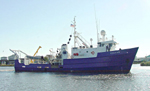 Pelican |
Damour, M., Chaytor, J., Jones, D., Brennan, M., Bentley, S., 2024, Shipwreck Sentinels: A Novel Approach for Monitoring Subsea Mudflows on the Mississippi River Delta Front: , Ocean Sciences Meeting 2024.
Figueredo, N., Bentley, S., Chaytor, J., Xu, K., Jafari, N., Georgiou, I., Miner, M., D'amour, M., Duxbury, J., Obelcz, J., Maloney, J., 2024, Sedimentary processes and instability on the Mississippi River Delta Front near the Wreck of the SS Virginia: , Ocean Sciences Meeting 2024.
Walton, F., Figueredo, N., Lester, S., King, D., Bergeron, A., Woodall, J., Bentley, S., Chaytor, J., Xu, K., Xue, Z.G., Jafari, N., Glaspie, C., Moore, J., D'amour, M., Georgiou, I., Miner, M., Howes, N., Obelcz, J., 2024, Short-Term Sediment Dispersal From Major Mississippi River Outlets Via 7Be And 234Th Geochronology: , Ocean Sciences Meeting 2024.
| Survey Equipment | Survey Info | Data Type(s) | Data Collected |
|---|---|---|---|
| GeoEel digital streamer | 1416 linear kilometers of multichannel seismic reflection data were collected with an Applied Acoustics S-Boom source and a 32-channel Geometrics Geoeel streamer. | Boomer Multichannel Sparker Air Gun / Water Gun Bubble Gun | |
| RBRsolo-D depth logger | 5 RBR solo depth loggers were spaced along the length of the active seismic streamer sections to log streamer depths during acquisition | Depth | |
| AML MVP30 | 422 water column sound velocity profiles were collected with an AML MVP30 moving vessel profiler. | Sound Velocity | |
| S-Boom seismic source | The data associated with this system are attached to the GeoEel streamer. Multichannel seismic-reflection data were shot using and Applied Acoustics S-Boom three plate boomer powered by an Applied Acoustics CSP-D power supply that was set to output 600 Joules. | Boomer | |
| Edgetech chirp subbottom profiler 512i | 1,992 linear kilometers of chirp sub-bottom data were collected with an Edgetech 512i chirp sub-bottom profiler. | Sub Bottom Profiler | |
| OSIL Mega Multiple Corer | --- | Chemistry Geology Biology | |
| Sparker | The sparker source was not used during 2022-004-FA | Sparker | No data was collected |
| Reson T20-P | --- | Multibeam Water column reflectivity |
