Other ID: Ocean Infinity Proj Num: 104313
Status: Pending
Organization(s): USGS, Woods Hole Coastal and Marine Science Center, National Oceanic and Atmospheric Administration, USGS, Wetland and Aquatic Research Center
Funding Program(s): Deepwater Atlantic Habitats II: Continued Atlantic Research and Exploration in Deepwater Ecosystems with Focus on Coral, Canyon, and Seep Communities (GX.17LQ00.FFV85.00)
Principal Investigator(s): Jason Chaytor
Affiliate Investigator(s): Amanda Demopoulos, WARC
Information Specialist(s): Brian Andrews
Data Type(s): Sonar: Sidescan, Sonar: Multibeam, Seismics: Sub Bottom Profiler, Imagery: Photo, Environmental Data: CTD
Scientific Purpose/Goals: High resolution mapping and photographic imaging of past nodule extraction activities
Vehicle(s):
Start Port/Location: New Bedford, MA
End Port/Location: Charleston, SC
Start Date: 2022-07-31
End Date: 2022-08-12
Equipment Used: Other, Other, Digital camera, Other
Information to be Derived: Seafloor morphology, sub-bottom structure, benthic environmental characterization
Summary of Activity and Data Gathered: Data were collected using a Hugin 6000 AUV launched from the M/V Deep Helder during 7 dives between Aug 5th and 11th. Data were collected along 758 linear kilometers of survey lines covering approximately 29 square kilometers.
Staff: Jason Chaytor
Affiliate Staff:
Notes: This survey was originally planned for the NOAA Ship Nancy Foster, but is now using the M/V Deep Helder owned and operated by MMT/Ocean Infinity https://www.mmt.se/fleet/deep-helder/
Location:
Blake Plateau
| Boundaries | |||
|---|---|---|---|
| North: 31.0724452 | South: 30.9938278 | West: -78.4287416 | East: -78.3462152 |
Platform(s):
Other |  Deep Helder | 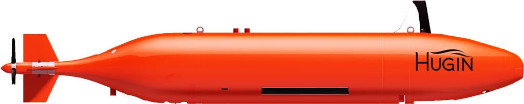 Hugin 6000 AUV |
Chaytor, J., Rasser, M.K., Demopoulos, A.W.J., Knorr, P.O., Mizell, K., Mueller, M.S., Andrews, B.D., Cuellar, S., 2024, Assessment of Long-Term Impacts to Seabed Environments of the Blake Plateau from Historic Manganese Nodule Extraction Equipment Testing: , Ocean Sciences Meeting 2024.
| Survey Equipment | Survey Info | Data Type(s) | Data Collected |
|---|---|---|---|
| Other | --- | --- | --- |
| Other | --- | --- | --- |
| Digital camera | --- | Photo | |
| Other | --- | --- | --- |
