Other ID: Martens cruise
Status: Pending
Organization(s): USGS, Woods Hole Coastal and Marine Science Center
Funding Program(s): USGS GAS HYDRATES (LQ000FP)
Principal Investigator(s): Carolyn Ruppel
Affiliate Investigator(s): Chris Martens (UNC-Chapel Hill); Howard Mendlovitz (UNC-Chapel Hill)
Information Specialist(s): Eric Moore
Data Type(s): Sonar: Multibeam
Scientific Purpose/Goals: USGS purpose: Collect EK80 data to support NSF-funded seep-based project for Prof Chris Martens at UNC
Vehicle(s):
Start Port/Location: Lewes, DE
End Port/Location: Lewes, DE
Start Date: 2022-07-31
End Date: 2022-08-11
Equipment Used: Simrad EK80
Information to be Derived: EK80 imagery
Summary of Activity and Data Gathered: Collect continuous EK80 data to identify active methane seepage during deployments of Martens' landers
Staff: Charles Worley, Eric Moore
Affiliate Staff:
as determined by SFMG for staffing
Notes: EK80 with 38 kHz transducer and custom Sharp tranducer mount
Location:
Upper continental slope Delaware to Hatteras
| Boundaries | |||
|---|---|---|---|
| North: 39.50404071 | South: 34.34343607 | West: -75.41015625 | East: -72.59765625 |
Platform(s):
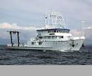 Hugh R. Sharp |
| Survey Equipment | Survey Info | Data Type(s) | Data Collected |
|---|---|---|---|
| Simrad EK80 | --- | Water column reflectivity Multibeam |
