Other ID: Head of the Meadow 2022
Status: Completed
Organization(s): USGS, Woods Hole Coastal and Marine Science Center
Funding Program(s): Coastal Model Applications and Field Measurements (LQ00DYN)
Principal Investigator(s): Christopher Sherwood
Affiliate Investigator(s): Peter Traykovski (WHOI)
Information Specialist(s): Jin-Si Over
Data Type(s): Sonar: Single Beam, Location-Elevation: Navigation, Imagery: Photo
Scientific Purpose/Goals: To characterize the beach and nearshore morphology used to validate the USGS Total Water Level and Coastal Change Forecast and use of ARGUS Camera systems (CoastCams) to visualize and map the beach and nearshore region to determine the types of bar morphologies, their persistence and temporal variability, and the relationship of these changes to wave and water-level conditions. This includes subaerial survey measurements to map beach; aerial imagery from kite/balloon (Heli-kite) to map beach; bathymetric soundings from WHOI autonomous surface vehicle to map nearshore. Surveys are repeat from 2020-015-FA and 2021-014-FA at Head of the Meadow.
Vehicle(s):
Start Port/Location: Falmouth, MA
End Port/Location: Falmouth, MA
Start Date: 2022-03-10
End Date: 2022-03-18
Equipment Used: UAS- heli-kite, Cerulean Sonar S-500 Sounder, PPK GPS, Spectra Precision SP80, Digital camera, Aeropoint targets
Information to be Derived: Updated year of change at Head of the Meadow of the topography and bathymetry of the beach and nearshore region in view of the cameras.
Summary of Activity and Data Gathered: Field Surveys took two days. Helikite survey was completed at low tide with a mix of Aeropoints and tarp targets as ground control. RTK GPS measurements and Propeller network were within 2 cm. PPK GPS data on camera was post processed. Bathymetry was collected a week after the helikite survey - ASV Yellowfin with a single beam echosounder was successful. No issues.
Staff: Noa Randall, Jin-Si Over, Christopher Sherwood
Affiliate Staff:
Notes: 2022-03-10 Head of the Meadow was surveyed with RTK equipment and helium balloon kite (J. Over, C. Sherwood, N. Randall, P. Traykovski).
2022-03-18 Bathymetry surveyed with Yellowfin and single-beam, very foggy (J. Over and P. Traykovski)
Location:
Head of the Meadow Beach, Truro Cape Cod National Seashore, Barnstable County, MA, United States
| Boundaries | |||
|---|---|---|---|
| North: 42.05933014 | South: 42.04906957 | West: -70.08041382 | East: -70.06998539 |
Platform(s):
 on foot | 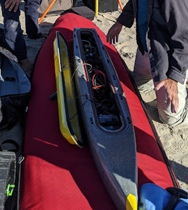 WHOI Yellowfin |
Over, J.R., Sherwood, C.R., and Traykovski, P.A., 2022, Topographic and bathymetric data, structure from motion imagery, and ground control data collected at Head of the Meadow Beach, Truro, MA in March 2022, U.S. Geological Survey Field Activity 2022-015-FA: U.S. Geological Survey data release, https://doi.org/10.5066/P9GEVWG1.
Sherwood, C.R., Aretxabaleta, A.L., Traykovski, P.A., Over, J.R., Lyons, E.O., Foster, D.S., Miselis, J.L., Nelson, T.R., Sogut, E., 2023, Contributions to uncertainty in runup forecasts: , Proceedings of Coastal Sediment 2023. doi: 10.1142/9789811275135_0037.
Sherwood, C.R., Foster, D.S., Miselis, J.L., Over, J.R., Marsjanik, E.D., Traykovski, P., 2022, Variability of Cape Cod Bars: Changes over Space and Time: , Cape Cod National Seashore 2022 Science in the Seashore Symposium.
| Survey Equipment | Survey Info | Data Type(s) | Data Collected |
|---|---|---|---|
| UAS- heli-kite | Filled with helium and towed by hand up and down the beach with a digital camera and ppk GPS attached. | Photo Navigation Video | |
| Cerulean Sonar S-500 Sounder | placed in ASV to record depth to seafloor | Single Beam | 2022015FA_Truro_bathymetry (Bathymetric data and grid of offshore Head of the Meadow Beach, Truro, on March 18, 2022) 2022015FA_Truro_topobathy (Topobathy grid representing the backshore to the nearshore at Head of the Meadow Beach, Truro from data collected on March 10 and 18, 2022) |
| PPK GPS | Hot shoed to the camera so there is highly accurate photo location information and attached to ASV for accurate echosounder point location information | Navigation | |
| Spectra Precision SP80 | used in RTK mode to provide location information to the tarp targets used as ground control | Navigation | 2022015FA_Truro_navigation (Ground control points at Head of the Meadow Beach, Truro on March 10, 2022) |
| Digital camera | JPEG taken every 2 seconds. | Photo | 2022015FA_Truro_DSM (Digital surface model representing Head of the Meadow Beach, Truro on March 10, 2022) 2022015FA_Truro_imagery (Low-altitude aerial imagery collected from a Helikite at Head of the Meadow Beach, Truro on March 10, 2022. Includes image locations.) 2022015FA_Truro_ortho (Orthomosaic representing Head of the Meadow Beach, Truro on March 10, 2022) |
| Aeropoint targets | Placed in survey area as ground control for structure from motion | Navigation Transects Profiles |
