Other ID: none
Status: Pending
Organization(s): USGS, Woods Hole Coastal and Marine Science Center, University of Maryland Center for Environmental Science
Funding Program(s): Estuarine Processes, Hazards, and Ecosystems ?mid-Atlantic (LQ00UHB)
Principal Investigator(s): John Pohlman
Affiliate Investigator(s): Laura Lapham, University of Maryland Center for Environmental Science
Information Specialist(s): Michael Casso
Data Type(s): Seismics: Sub Bottom Profiler, Sampling: Chemistry, Environmental Data: CO2, Environmental Data: Methane, Environmental Data: CTD, Geochemical: Surveys (geochemical)
Scientific Purpose/Goals: Measure greenhouse gas (methane and CO2) distribution in sediment and water and fluxes across sea-air interface
Vehicle(s):
Start Port/Location: Solomons MD, USA
End Port/Location: Solomons MD, USA
Start Date: 2022-07-22
End Date: 2022-08-01
Equipment Used: Edgetech 3400, Rhizons, Pore water sampling, Niskin bottle, Cavity Ring-Down Spectroscopy (CRDS), SBE 9 CTD, USGS-GAS
Information to be Derived: surface water gas concentration subsurface water gas concentration sediment gas distribution
Summary of Activity and Data Gathered: Conduct daily surveys at 5 sites from the freshwater to saline portion of the bay. Daily surveys include chirp sonar, sediment coring and water column profiling
Staff: David Foster, Wayne Baldwin, Michael Casso
Affiliate Staff:
Notes:
Location:
Chesapeake Bay
| Boundaries | |||
|---|---|---|---|
| North: 39.55 | South: 36.86 | West: -77.55 | East: -75.58 |
Platform(s):
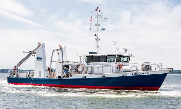 Rachel Carson (Univ. Maryland) |
Foster, D.S., Baldwin, W.E., Pohlman, J.W., and Lapham, L.L., 2025, Chirp seismic reflection and navigation data collected in Chesapeake Bay during USGS Field Activity 2022-020-FA: U.S. Geological Survey data release, https://doi.org/10.5066/P13DCCU3.
| Survey Equipment | Survey Info | Data Type(s) | Data Collected |
|---|---|---|---|
| Edgetech 3400 | --- | Sub Bottom Profiler | 2022-020-FA_ET3400 (Chirp seismic reflection and navigation data collected in Chesapeake Bay during USGS Field Activity 2022-020-FA. Includes profile images and SEG-Y data, trackline and shotpoint navigation.) |
| Rhizons | --- | Chemistry | |
| Pore water sampling | --- | Chemistry | |
| Niskin bottle | --- | Chemistry | |
| Cavity Ring-Down Spectroscopy (CRDS) | --- | CO2 Methane Experiments (geochemical) Surveys (geochemical) Chemistry | |
| SBE 9 CTD | --- | CTD | |
| USGS-GAS | --- | Surveys (geochemical) Experiments (geochemical) Chemistry Geochemical Monitoring CO2 Methane |
