AKA: none
Other ID: Winter bathymetric survey, Jenkinson Lake, CA
Status: Completed
Organization(s): USGS, Pacific Coastal and Marine Science Center
Funding Program(s): Other (Other), Landscape Response to Disturbance (ZP00TJV)
Principal Investigator(s): Amy East
Affiliate Investigator(s):
Information Specialist(s): Joshua Logan
Data Type(s): Sonar: Interferometric, Sonar: Single Beam, Location-Elevation: Navigation
Scientific Purpose/Goals: Conduct baseline bathymetric survey of Jenkinson Lake for change detection work in response to Caldor fire in northern California
Vehicle(s):
Start Port/Location: Santa Cruz, CA
End Port/Location: Santa Cruz, CA
Start Date: 2022-01-10
End Date: 2022-01-14
Equipment Used: GPS, Fathometer, Interferrometric
Information to be Derived: bathymetry
Summary of Activity and Data Gathered: Swath mapping of Jenkinson Lake was conducted using the R/V San Lorenzo 2022-01-10 - 2022-01-12. Single-beam mapping was conducted in the shallow upper portion of the lake using the CEEscope echosounder on a rigid-hull inflatable boat 2022-01-11 - 2022-01-12. Average daily lake levels recorded by El Dorado Irrigation District were approximately 3,448 ft (98 ft level), 67% of full. Area of bathymetric data collection on the reservoir delta at Hazel Creek and Sly Park Creek overlapped considerably with the lateral extent of the topographic UAS surveys conducted on 2021-10-13 (FAN 2021-655-FA) and 2021-11-04 (FAN 2021-659-FA), during which the water surface elevation was lower.
Staff: Peter Dartnell, Jackson Currie, Daniel Powers, Joshua Logan
Affiliate Staff:
Notes: Entries for this field activity are based on entries from Field Activity 2021-659-FA.
Location:
Northern CA
| Boundaries | |||
|---|---|---|---|
| North: 38.74256967 | South: 38.70533855 | West: -120.58216095 | East: -120.51074982 |
Platform(s):
 Raft | 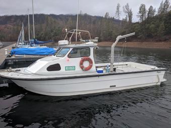 San Lorenzo |
Dartnell, P., East, A.E., Logan, J., Hatcher G.A, Currie, J.E., Marcuson, R.K., Powers, D.C., Dal Ferro, P., and McKee, J.A., 2024, Bathymetry and Acoustic Backscatter data for Jenkinson Lake, California collected during three USGS field activities, 2022-604-FA, 2022-649-FA, and 2023-634-FA: U.S. Geological Survey data release, https://doi.org/10.5066/P13BSSDY.
| Survey Equipment | Survey Info | Data Type(s) | Data Collected |
|---|---|---|---|
| GPS | --- | Navigation | |
| Fathometer | --- | Single Beam | |
| Interferrometric | --- | Interferometric | Acoustic-backscatter data for Jenkinson Lake, California collected during USGS field activity 2022-604-FA (Here January 2022 1-m resolution acoustic-backscatter data are provided for Jenkinson Lake, California. Acoustic-backscatter data were collected during three separate SWATHPlus surveys of Jenkinson Lake.) |
