AKA: none
Other ID: Escanaba 2022; TN-403
Status: Pending
Organization(s): USGS, Pacific Coastal and Marine Science Center
Funding Program(s): Other (Other)
Principal Investigator(s): Amy Gartman
Affiliate Investigator(s): Amanda Demopoulos (USGS); Nancy Prouty (USGS); Kiana Frank (University of Hawaii); Isobel Yeo (Southampton); John Jamieson (Memorial University); Joe Resing (NOAA)
Information Specialist(s):
Data Type(s): Environmental Data: ORP, Environmental Data: CTD, Sonar: Sidescan, Sonar: Multibeam, Imagery: Video, Electro-Magnetic: Magnetics, Sampling: Geology, Sampling: Biology, Sampling: Chemistry
Scientific Purpose/Goals: We will be studying the Escanaba Trough to characterize the sulfide minerals and hydrothermal fluids in Escanaba Trough in order to investigate the continuity of both through time; to characterize the ecosystem, including microbes and megafauna inhabiting the trough; and to explore interactions between marine life, the metal sulfide deposits, and the hydrothermal and oceanic environment enveloping both. We will also be doing AUV based mapping.
Vehicle(s):
Start Port/Location: Newport, OR
End Port/Location: Newport, OR
Start Date: 2022-05-24
End Date: 2022-06-13
Equipment Used: Push corer, Hand-grab sample, Gravity Core, High Temperature Major Samplers, High Temperature Gas Tight Samplers, Magnetometer, Camera-video, Side-scan sonar, CTD - FSI, niskin bottle, PMEL MAPR
Information to be Derived: Mineral distribution; metal sulfide geochemistry; species distribution; microbiology distribution; water column chemistry; hydrothermal fluid chemistry; sediment geochemistry; organic geochemistry
Summary of Activity and Data Gathered: 20 days at sea on R/V Thompson using ROV Jason, AUV Sentry, gravity coring, and CTD casts
Staff:
Affiliate Staff:
Notes:
Location:
Escanaba Trough; Southern Gorda Ridge; US EEZ; Offshore CA
| Boundaries | |||
|---|---|---|---|
| North: 41.15 | South: 40.2 | West: -127.53 | East: -127.35 |
Platform(s):
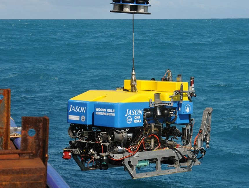 ROV Jason |
Adamczyk, K.B., Gartman, A., Favela, J., Tidwell, J., 2025, Computed tomography (CT) scans, photographs, geochemistry, grain-size and total carbon analysis, X-ray fluorescence (XRF) scans, X-ray diffraction (XRD), magnetic susceptibility, and gamma-ray bulk density data of gravity cores and push cores from the Escanaba Trough (Gorda Ridge): U.S. Geological Survey data release, https://doi.org/10.5066/P13B46QX.
Galley, C., Sorenson, D., Shapiro, I.M., Gartman, A., 2026, Magnetics Data from the Escanaba Trough (Gorda Ridge): U.S. Geological Survey data release, doi.org/10.5066/P1DRPIQK.
Ianiri, H.L., Prouty, N.G., Campbell, P.L., Gartman, A., Adamczyk, K.B., Favela, J.J., 2025, Sedimentary organic geochemistry data from Escanaba Trough, off the coast of northern California, collected May-June 2022: U.S. Geological Survey data release, https://doi.org/10.5066/P13XVXQC.
Phan, K.C., Shapiro, I.M., Ruth, D.C.S., Gartman, A., 2026, Microprobe data for rock samples from the Escanaba Trough (Gorda Ridge): U.S. Geological Survey data release, doi.org/10.5066/P1KXSK8I.
Shapiro, I.M., Favela, J., Adamczyk, K.B., Gartman, A., 2026, Geochemistry and x-ray diffraction data of rock samples from the Escanaba Trough (Gorda Ridge): U.S. Geological Survey data release, doi.org/10.5066/P1DJPX9G.
| Survey Equipment | Survey Info | Data Type(s) | Data Collected |
|---|---|---|---|
| Push corer | --- | Chemistry Surveys (geochemical) Surveys (biological) Biology Geology | Sediment porewater nutrient data from the Escanaba Trough, off the coast of Northern California, USA, from May-June 2022 (Nutrients were measured from porewaters of sediment within the Escanaba Trough, a hydrothermal spreading center. Location information (latitude, longitude, and depth) is also reported.) Grain size of bulk sediments from the Escanaba Trough, off the coast of Northern California, USA, from May-June 2022 (Sediment grain size was determined on one to five cm subsamples of push cores collected from the Escanaba Trough during May to June 2022.) Compound specific isotope analysis of amino acids from Escanaba Trough sediments, off the coast of Northern California, USA, from May-June 2022 (Stable carbon isotope ratios (d13C), stable nitrogen isotope ratios (d15N), and molar percentage data of amino acids were determined on one to five cm subsamples of sediment push cores collected from the Escanaba Trough during May to June 2022.) Organic geochemistry data of bulk sediments from the Escanaba Trough, off the coast of Northern California, USA, from May-June 2022 (Bulk organic geochemistry data were determined on one to five cm subsamples of sediment push cores collected from the Escanaba Trough during May to June 2022. These data include percent total organic carbon (percent TOC ), total nitrogen (percent TN), carbon to nitrogen ratios (C/N), stable carbon isotope ratios (d13C), stable nitrogen isotope ratios (d15N), radiocarbon values (D14C), and grain size (mean phi). Location information (for example , latitude, longitude, and depth) is also reported.) Lipid biomarker data from Escanaba Trough sediments, off the coast of Northern California, USA, from May-June 2022 (Lipid biomarkers, including n-alkanes, polycyclic aromatic hydrocarbons (PAHs), and sterols, were measured on sediments from the Escanaba Trough, a hydrothermal spreading center off the coast of Northern CA.) Organic geochemistry data of carbon fractions from Escanaba Trough sediments, off the coast of Northern California, USA, from May-June 2022 (Organic carbon fractions representing different labilities were extracted from sediments collected in the Escanaba Trough from May and June 2022. Organic carbon fractions included the total lipid extract and acid insoluble material. These fractions were analyzed for percent total organic carbon (TOC), total nitrogen (TN), stable carbon isotope ratios (d13C), stable nitrogen isotope ratios (d15N) and radiocarbon values (D14C). Percent TOC and TN data was used to calculate the contribution of each organic carbon fraction to the total organic carbon.) |
| Hand-grab sample | --- | Biology Chemistry Geology | X-ray diffraction data for bulk samples from the Escanaba Trough (Gorda Ridge) (This data release contains x-ray diffraction data of rock samples collected from the Escanaba Trough hydrothermal vent field, Gorda Ridge, in the northeast Pacific Ocean. These data were collected in 2022 on expedition TN403 (USGS Field Activity 2022-621-FA). Samples were taken to the USGS Pacific Coastal Marine Science Center for subsampling and x-ray diffraction analyses. Powder x-ray diffraction data for bulk samples of minerals are provided in this dataset. Location information (latitude, longitude, depth) for each sample are provided in each Attribute Definition of this metadata file.) X-ray diffraction data for oxidized subsamples from the Escanaba Trough (Gorda Ridge) (This data release contains x-ray diffraction data of rock samples collected from the Escanaba Trough hydrothermal vent field, Gorda Ridge, in the northeast Pacific Ocean. These data were collected in 2022 on expedition TN403 (USGS Field Activity 2022-621-FA). Samples were taken to the USGS Pacific Coastal Marine Science Center for subsampling and x-ray diffraction analyses. Powder x-ray diffraction data for the rind layer of the rocks are provided in this dataset. Location information (latitude, longitude, depth) for each sample are provided in each Attribute Definition of this metadata file.) Major, minor, and trace element data for rock samples from the Escanaba Trough (Gorda Ridge) (This data release contains geochemical data of rock samples collected from the Escanaba Trough hydrothermal vent field, Gorda Ridge, in the northeast Pacific Ocean. These data were collected in 2022 on expedition TN403 (USGS Field Activity 2022-621-FA). Samples were taken to the USGS Pacific Coastal Marine Science Center for subsampling and geochemical analyses. Data include major, minor, and trace element concentrations, location information (latitude, longitude, depth), analytical methods, and instrument detection limits where available.) Major, minor, and trace element data for oxidized samples from the Escanaba Trough (Gorda Ridge) (This data release contains geochemical data of oxidized subsamples of rock samples collected from the Escanaba Trough vent field, Gorda Ridge, in the northeast Pacific Ocean. These data were collected in 2022 on expedition TN403 (USGS Field Activity 2022-621-FA). Samples were taken to the USGS Pacific Coastal Marine Science Center for subsampling and geochemical analyses. Data include major, minor, and trace element concentrations, location information (latitude, longitude, depth), analytical methods, and instrument detection limits where available.) Microprobe data for rock samples from the Escanaba Trough (Gorda Ridge) (This data release contains electron microprobe data collected on thin sections made from rock samples collected from the Escanaba Trough hydrothermal vent field, Gorda Ridge, in the northeast Pacific Ocean. These data were collected in 2022 on expedition TN403 (USGS Field Activity 2022-621-FA). Samples were taken to the USGS Pacific Coastal Marine Science Center for subsampling and geochemical analyses. Data include element composition, instrument detection limits and error, assigned standards, and analytical methods where applicable.) |
| Gravity Core | --- | Geology | |
| High Temperature Major Samplers | --- | Chemistry | |
| High Temperature Gas Tight Samplers | --- | Chemistry | |
| Magnetometer | --- | Magnetics | Magnetics Data from the Escanaba Trough (Gorda Ridge) (This data release provides access to magnetics data collected by the AUV Sentry during the TN403 cruise in the Escanaba Trough (USGS Field Activity 2022-621-FA).) |
| Camera-video | --- | Photo Video | |
| Side-scan sonar | --- | Sidescan | |
| CTD - FSI | --- | CTD Mooring (physical oceanography) | |
| niskin bottle | --- | Chemistry | |
| PMEL MAPR | --- | ORP |
