AKA: none
Other ID: Gorda Waveglider Survey
Status: Completed
Organization(s): USGS, Pacific Coastal and Marine Science Center, Scripps Institution Of Oceanography, La Jolla, Ca, USGS, Earthquake Hazards
Funding Program(s): Other (Other), Coastal and marine earthquake, tsunami, and landslide active margin field studies (ZP00EQV)
Principal Investigator(s): Ben Brooks, Janet Watt
Affiliate Investigator(s): Todd Ericksen, Ben Brooks, Mark Zumberge, David Price
Information Specialist(s): Other , Janet Watt
Data Type(s): Location-Elevation: Benchmarks
Scientific Purpose/Goals: Survey 2 new GPS-A seafloor geodetic stations installed in October 2021 using a waveglider to characterize shallow interseismic locking in southern Cascadia
Vehicle(s): None
Start Port/Location: Eureka, CA
End Port/Location: Eureka, CA
Start Date: 2022-04-30
End Date: 2022-05-02
Equipment Used: GNSS-A
Information to be Derived: GNSS-A horizontal velocity
Summary of Activity and Data Gathered: Waveglider successfully launched by R/V Zephyr on 05/01/22. Locations of 2 seafloor geodetic stations were recorded.
Staff: Rachel Marcuson
Affiliate Staff:
Notes: Using contract vessel R/V Zephyr
Location:
Offshore Crescent City, CA
| Boundaries | |||
|---|---|---|---|
| North: 42.06832545 | South: 41.60585918 | West: -125.74039758 | East: -124.71650919 |
Platform(s):
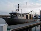 Zephyr |
| Survey Equipment | Survey Info | Data Type(s) | Data Collected |
|---|---|---|---|
| GNSS-A | --- | Benchmarks |
