AKA: none
Other ID: none
Status: Completed
Organization(s): USGS, Pacific Coastal and Marine Science Center
Funding Program(s): Other (Other)
Principal Investigator(s): Nancy Prouty
Affiliate Investigator(s): Stacey Harter (NOAA)
Information Specialist(s): Joanne Thede
Data Type(s): Sampling: Chemistry, Environmental Data: CTD
Scientific Purpose/Goals: Evaluate deep sea and mesophotic coral communities impacted and reference sites in the northern Gulf of America (Gulf of Mexico) in response to the 2010 DWH Oil Spill.
Vehicle(s): None
Start Port/Location: Pascagoula, MS
End Port/Location: Pascagoula, MS
Start Date: 2022-06-29
End Date: 2022-07-30
Equipment Used: Other, CTD_SeaBird
Information to be Derived: CTD (instrumental data and discrete water column nutrient data) operations at known impacted and reference sites in the northern Gulf of America (Gulf of Mexico) in response to the 2010 DWH Oil Spill.
Summary of Activity and Data Gathered: 35 CTD casts we conducted at water depths <200 m. Water samples were collected at discrete sample depths within the water column, preserved and are pending for nutrient analysis. Raw CTD is going to be processed in preparation for data release.
Staff: Nadine Golden
Affiliate Staff:
Notes: Vessel: NOAA Ship Pisces
Cruise Dates:
Leg 1: June 29 - July 14, 2022. Pascagoula, MS
Leg 2: July 17 - July 30, 2022. Pascagoula, MS
Location:
Gulf of America (Gulf of Mexico)
| Boundaries | |||
|---|---|---|---|
| North: 30.44867368 | South: 25.48295118 | West: -95.62479776 | East: -80.85728517 |
Platform(s):
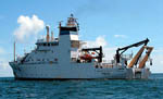 Pisces |
| Survey Equipment | Survey Info | Data Type(s) | Data Collected |
|---|---|---|---|
| Other | --- | --- | --- |
| CTD_SeaBird | --- | CTD |
