AKA: none
Other ID: Conconully Wildfire
Status: Pending
Organization(s): USGS, Pacific Coastal and Marine Science Center, USGS, Tacoma, Washington
Funding Program(s): Other (Other)
Principal Investigator(s): Renee Takesue
Affiliate Investigator(s): Nicholas Sutfin, USGS Washington Water Science Center
Information Specialist(s): Renee Takesue
Data Type(s): Sampling: Geology, Sampling: Chemistry, Location-Elevation: Navigation
Scientific Purpose/Goals: Explore how fire activity contributed to reservoir sedimentation.
Vehicle(s): None
Start Port/Location: Conconully, WA
End Port/Location: Conconully, WA
Start Date: 2022-06-25
End Date: 2025-06-25
Equipment Used: Vibracore, Gravity Core, core, Hand-grab sample, Garmin
Information to be Derived: Historical records of fire activity and sediment accumulation rates from sediment compositional chemistry, charcoal counts, and radionuclide chronologies.
Summary of Activity and Data Gathered: Collect watershed soil, stream sediment, and historical sediment records from the reservoir.
Staff:
Affiliate Staff:
Notes:
Location:
Conconully, WA
| Boundaries | |||
|---|---|---|---|
| North: 48.88308168 | South: 48.28227826 | West: -120.15380856 | East: -119.35546854 |
Platform(s):
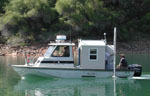 Frontier | Other |  on foot |
Takesue, R.K., Hallas, L.P., Spanjer, A.R., Arslan, Z., Sutfin, N.A., 2025, Charcoal and soil, water, and reservoir sediment-core chemistry in the North Fork Salmon Creek basin and Conconully Reservoir, Washington, 2022-2023: U.S. Geological Survey Data Release, https://doi.org/10.5066/P1948ERW.
| Survey Equipment | Survey Info | Data Type(s) | Data Collected |
|---|---|---|---|
| Vibracore | --- | Chemistry Geology | |
| Gravity Core | --- | Geology | |
| core | --- | Chemistry Biology Geology | |
| Hand-grab sample | --- | Biology Chemistry Geology | |
| Garmin | --- | Navigation |
