Other ID: Tyndall Reefense vibracoring on R/V Apalachee
Status: Pending
Organization(s): USGS, St. Petersburg Coastal and Marine Science Center
Funding Program(s): Coastal Sediment Availability and Flux - CSAF (GX.26.MN00.M0Y60.00)
Principal Investigator(s): Emily Wei, Jennifer Miselis
Affiliate Investigator(s): Defense Advanced Research Projects Agency; US Army Corps of Engineers
Information Specialist(s): Nancy DeWitt, Emily Wei
Data Type(s): Sampling: Geology, Location-Elevation: Navigation
Scientific Purpose/Goals: Vibracore acquisition in support of efforts to construct an artificial oyster reef.
Vehicle(s): Ford F-350 Dually Grey (GSA)
Start Port/Location: Panama City, FL
End Port/Location: Panama City, FL
Start Date: 2023-04-23
End Date: 2023-04-27
Equipment Used: Grab Sampler, Rossfelder P3-C Vibracorer, SP90 GNSS Receiver
Information to be Derived: Sediment vibracores
Summary of Activity and Data Gathered:
Staff: Kyle Kelso, Benjamin Galbraith, Nancy DeWitt, Emily Wei
Affiliate Staff:
Notes: Entries for this field activity are based on entries from Field Activity 2022-312-FA.
Personnel may change; will edit.
Location:
Panama City, FL, United States, Gulf of America (Gulf of Mexico)
| Boundaries | |||
|---|---|---|---|
| North: 30.15676461 | South: 30.01333874 | West: -85.71780396 | East: -85.48324585 |
Platform(s):
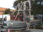 Barge | 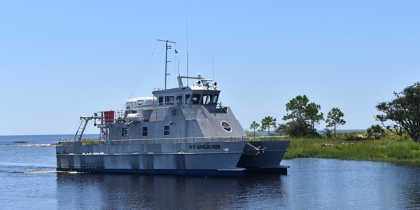 Apalachee |
Mahan, S.A., Krolczyk, E.T., Wei, E.A., Randall, S.M., and Bernier, J.C., 2024, Data Release for Luminescence: Tyndall Air Force Base, Panama City, Florida estuarine sediment cores: U.S. Geological Survey data release, https://doi.org/10.5066/P142G7PC.
Wei, E.A., Randall, S., Bernier, J.C., Everhart, C.S., DeWitt, N.T., 2024, Sedimentologic Data From Vibracores Collected in 2023 From St. Andrew Bay, Florida: U.S. Geological Survey data release, https://doi.org/10.5066/P1AFJDNE.
| Survey Equipment | Survey Info | Data Type(s) | Data Collected |
|---|---|---|---|
| Grab Sampler | --- | Biology Geology | |
| Rossfelder P3-C Vibracorer | --- | Geology | 2023-309-FA_CoreSites (Site location information and parameters for 2023-309-FA vibracores) 2023-309-FA_CorePhotos (High-resolution photographs for 2023-309-FA vibracores and script file used to populate imagery headers) 2023-309-FA_GrainSizeData (Grain-size data, summary statistics, summary plots, and data dictionary for 2023-309-FA vibracore samples) 2023-309-FA_AgeControl (Results of radiocarbon (14C) analyses and data dictionary for 2023-309-FA vibracore samples ) 2023-309-FA_LossOnIgnition (Results of Loss on Ignition analyses from 2023-309-FA vibracore samples) |
| SP90 GNSS Receiver | --- | Benchmarks Navigation |
