AKA: none
Other ID: Jenkinson Lake
Status: Pending
Organization(s): USGS, Pacific Coastal and Marine Science Center
Funding Program(s): Landscape Response to Disturbance (ZP00TJV)
Principal Investigator(s): Amy East
Affiliate Investigator(s):
Information Specialist(s): Peter Dartnell
Data Type(s): Sonar: Interferometric
Scientific Purpose/Goals: Map any post-winter sediment deposits in Jenkinson Lake following the 2021 Caldor wildfire
Vehicle(s): Ford Explorer - Blue - G62-2733K
Start Port/Location: Placerville, CA
End Port/Location: Placerville, CA
Start Date: 2023-07-05
End Date: 2023-07-07
Equipment Used: Interferrometric
Information to be Derived: bathymetry, acoustic backscatter
Summary of Activity and Data Gathered:
Staff: Peter Dartnell
Affiliate Staff:
Notes:
Location:
Jenkinson Lake
| Boundaries | |||
|---|---|---|---|
| North: 38.76511977 | South: 38.67328039 | West: -120.61735128 | East: -120.46159834 |
Platform(s):
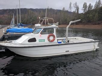
 San Lorenzo |
Dartnell, P., East, A.E., Logan, J., Hatcher G.A, Currie, J.E., Marcuson, R.K., Powers, D.C., Dal Ferro, P., and McKee, J.A., 2024, Bathymetry and Acoustic Backscatter data for Jenkinson Lake, California collected during three USGS field activities, 2022-604-FA, 2022-649-FA, and 2023-634-FA: U.S. Geological Survey data release, https://doi.org/10.5066/P13BSSDY.
| Survey Equipment | Survey Info | Data Type(s) | Data Collected |
|---|---|---|---|
| Interferrometric | --- | Interferometric | Acoustic-backscatter data for Jenkinson Lake, California collected during USGS field activity 2023-634-FA (Here July 2023 1-m resolution acoustic-backscatter data are provided for Jenkinson Lake, California.) Bathymetry data for Jenkinson Lake, California collected during USGS field activity 2023-634-FA (Here July 2023 1-m resolution bathymetry data of Jenkinson Lake, California are provided for the entire lake and 0.5-m resolution bathymetry data are provided for the shallower upper basin.) |