AKA: none
Other ID: none
Status: Pending
Organization(s): USGS, Pacific Coastal and Marine Science Center
Funding Program(s): Coastal and marine earthquake, tsunami, and landslide active margin field studies (ZP00EQV)
Principal Investigator(s): Jared Kluesner
Affiliate Investigator(s): William Wilcock, University of Washington
Information Specialist(s): Jared Kluesner
Data Type(s): Seismics: Ocean Bottom Seismometer, Seismics: Sub Bottom Profiler
Scientific Purpose/Goals: Collect OBS and subbottom sonar data.
Vehicle(s):
Start Port/Location: Newport, Oregon
End Port/Location: Newport, Oregon
Start Date: 2023-08-31
End Date: 2023-09-05
Equipment Used: Kongsberg SBP 29, seismograph
Information to be Derived: Seismic events recorded on OBS instruments and information on sediment and deformation structures.
Summary of Activity and Data Gathered:
Staff: George Snyder, Jared Kluesner
Affiliate Staff:
Notes:
Location:
Continental slope along Cascadia out to Axial Seamount
| Boundaries | |||
|---|---|---|---|
| North: 46.9652594 | South: 42.81152175 | West: -131.24267578 | East: -123.75 |
Platform(s):
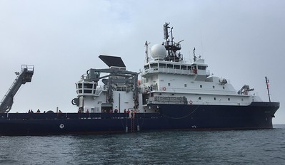 Sally Ride |
| Survey Equipment | Survey Info | Data Type(s) | Data Collected |
|---|---|---|---|
| Kongsberg SBP 29 | --- | Sub Bottom Profiler | |
| seismograph | --- | Ocean Bottom Seismometer |
