Other ID: none
Status: Pending
Organization(s): USGS, St. Petersburg Coastal and Marine Science Center
Funding Program(s): Next-Generation Total Water Level and Coastal Change Forecast (GX.25.MN00.U0310.00)
Principal Investigator(s): Jennifer (Jenna) Brown, Margaret Palmsten
Affiliate Investigator(s):
Information Specialist(s):
Data Type(s): Environmental Data: Current, Environmental Data: Wave, Imagery: Video, Location-Elevation: Transects, Time Series: Mooring (physical oceanography)
Scientific Purpose/Goals: Measure waves, currents and runup to improve Total Water Level forecasts.
Vehicle(s): Ford Expedition Green, Ford F-350 Dually White (GSA)
Start Port/Location: Breton Island, LA
End Port/Location: Breton Island, LA
Start Date: 2024-05-11
End Date: 2024-05-21
Equipment Used: Sofar Spotter buoy, RBR Virtuoso pressure sensor, Digital Video, GPS Backpack, Pressure Logger
Information to be Derived: wave parameters, currents, water levels and runup
Summary of Activity and Data Gathered:
Staff: Nancy DeWitt, Johnathan Woodruff, Justin Birchler, David Thompson
Affiliate Staff:
Notes: Entries for this field activity are based on entries from Field Activity 2022-330-FA.
Location:
Breton Island, LA
| Boundaries | |||
|---|---|---|---|
| North: 29.5280603 | South: 29.36183017 | West: -89.26391602 | East: -88.99269104 |
Platform(s):
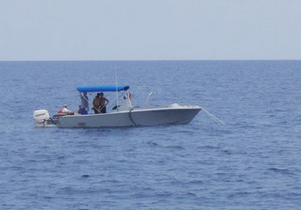
Other |  Halimeda |
| Survey Equipment | Survey Info | Data Type(s) | Data Collected |
|---|---|---|---|
| Sofar Spotter buoy | --- | Meteorology Pressure Temperature Wave | |
| RBR Virtuoso pressure sensor | --- | Current Depth ORP Turbidity pH Dissolved Oxygen Fluorescence Conductivity Tide Wave Pressure | |
| Digital Video | --- | Video | |
| GPS Backpack | --- | Navigation Profiles Transects | |
| Pressure Logger | --- | Mooring (physical oceanography) |