AKA: none
Other ID: none
Status: Pending
Organization(s): USGS, Pacific Coastal and Marine Science Center
Funding Program(s): Other (Other)
Principal Investigator(s): Nancy Prouty
Affiliate Investigator(s): Jill Bourque
Information Specialist(s): Nancy Prouty
Data Type(s): Biological Field Study: Surveys (biological)
Scientific Purpose/Goals: This project will provide critical data to NOAA and for the Mesophotic and Deep Benthic Communities (MDBC) projects. These data will be used for restoration and to guide future science-based management decisions. This expedition is part of the Open Ocean TIG Final Restoration Plan 2 for MDBC. This plan will have direct consequences for defining the distribution, connectivity, and ecology of vulnerable ecological communities and guiding wise use of the living marine and energy resources.
Vehicle(s): None
Start Port/Location: Gulfport, MS
End Port/Location: Gulfport, MS
Start Date: 2024-04-17
End Date: 2024-04-30
Equipment Used: sample
Information to be Derived: Environmental data to characterize deep benthic habitats with corals and associated ecosystems.
Summary of Activity and Data Gathered: Planned activities are high resolution mapping and CTD rosette casts for eDNA, POM and nutrient analysis.
Staff:
Affiliate Staff:
Jill Bourque (USGS Wetland & Aquatic Research Center)
Notes:
Location:
Gulf of America (Gulf of Mexico)
| Boundaries | |||
|---|---|---|---|
| North: 29.53522956 | South: 26.27371402 | West: -91.58203125 | East: -81.9140625 |
Platform(s):
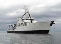
 Point Sur |
| Survey Equipment | Survey Info | Data Type(s) | Data Collected |
|---|---|---|---|
| sample | --- | Surveys (biological) |