AKA: none
Other ID: Eel River paleoseismology 2024
Status: Pending
Organization(s): USGS, Pacific Coastal and Marine Science Center
Funding Program(s): Coastal and marine earthquake, tsunami, and landslide active margin field studies (ZP00EQV)
Principal Investigator(s): SeanPaul La Selle, Jason Padgett
Affiliate Investigator(s): Brian Sherrod, Danny Brothers, Peter Pearsall, Brandon Nasr
Information Specialist(s): Jason Padgett, SeanPaul La Selle
Data Type(s): Environmental Data: Tide, Location-Elevation: Benchmarks, Sampling: Geology
Scientific Purpose/Goals: To collect sediment cores and modern foraminifera samples for reconstructing the magnitude and recurrence of great earthquakes in the far southern Cascadia Subduction Zone.
Vehicle(s): F350 G43-2783H
Start Port/Location: Ferndale, CA
End Port/Location: Ferndale, CA
Start Date: 2024-08-16
End Date: 2024-12-07
Equipment Used: RBR Virtuoso, RTK GPS, Push corer, Hand-grab sample, Vibracore
Information to be Derived: grain size, sea level reconstruction, radiocarbon age dating, CT scans
Summary of Activity and Data Gathered: Collected 8 russian cores, 4 monoliths, and 4 vibracores.
Staff:
Affiliate Staff:
Notes: Deployed 2 water level loggers (Hobos) and 1 atm sensor (Hobo). Planned retrieval (Nov-Dec).
Location:
Lower Eel River Valley
| Boundaries | |||
|---|---|---|---|
| North: 40.8018 | South: 40.4772 | West: -124.403 | East: -123.9972 |
Platform(s):
 Raft | 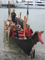 Canoe |  on foot |
| Survey Equipment | Survey Info | Data Type(s) | Data Collected |
|---|---|---|---|
| RBR Virtuoso | --- | Mooring (physical oceanography) Tide Wave Turbidity pH ORP Fluorescence Dissolved Oxygen Temperature Pressure CTD | |
| RTK GPS | --- | LIDAR Transects Benchmarks Profiles Navigation | |
| Push corer | --- | Chemistry Surveys (geochemical) Surveys (biological) Biology Geology | |
| Hand-grab sample | --- | Biology Chemistry Geology | |
| Vibracore | --- | Chemistry Geology |
