AKA: none
Other ID: Gorda install/measure 2024
Status: Pending
Organization(s): USGS, Pacific Coastal and Marine Science Center, USGS, Earthquake Hazards
Funding Program(s): Coastal and marine earthquake, tsunami, and landslide active margin field studies (ZP00EQV)
Principal Investigator(s): Ben Brooks, Janet Watt
Affiliate Investigator(s): Todd Ericksen, USGS Earthquake Hazards, Earthquake Science Center, Moffett Field
Information Specialist(s): Janet Watt
Data Type(s): Location-Elevation: Benchmarks
Scientific Purpose/Goals: To collect seafloor geodetic data for subduction zone science in Cascadia
Vehicle(s): MarFac; Crysler G12-0254S
Start Port/Location: Eureka, CA
End Port/Location: Eureka, CA
Start Date: 2024-08-25
End Date: 2024-08-28
Equipment Used: GNSS-A
Information to be Derived: Precise locations for 3 seafloor geodetic sites offshore southern Cascadia
Summary of Activity and Data Gathered:
Staff:
Affiliate Staff:
Notes:
Location:
Offshore Brookings, CA
| Boundaries | |||
|---|---|---|---|
| North: 42.23665188 | South: 40.63130609 | West: -124.95849609 | East: -123.81588309 |
Platform(s):
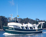 Coral Sea |
| Survey Equipment | Survey Info | Data Type(s) | Data Collected |
|---|---|---|---|
| GNSS-A | --- | Benchmarks |
