Other ID: Aleutians
Status: Pending
Organization(s): USGS, St. Petersburg Coastal and Marine Science Center
Funding Program(s): Other (Other)
Principal Investigator(s): Amy Gartman, Amanda Demopolous, Nancy Prouty, Jason Chaytor, Christina Kellogg
Affiliate Investigator(s):
Information Specialist(s): Julie Voelschow
Data Type(s): Visual Identification: Submersible Observations, Sonar: Multibeam, Seismics: Sub Bottom Profiler, Sampling: Geology, Sampling: Biology, Imagery: Photo, Environmental Data: Sediment Properties, Environmental Data: CTD, Biological Field Study: Experiments (biological)
Scientific Purpose/Goals: The Aleutian Arc is a tectonic convergence zone, including ecologically sensitive and economically important seafloor habitats, hazards, and resources including the prospective for hydrothermal marine minerals (Gartman et al., 2022). The Arc is one of the most remote and understudied regions of the U.S. Exclusive Economic Zone (EEZ). The unique combination of geologic and oceanographic features creates a heterogeneous environment of exposed rocky substrate, swift currents, and highly productive nutrient-rich waters, facilitating extensive deep-sea coral (DSC) and sponge grounds. Given that fishery bycatch of corals and sponges is a serious concern, exploration of these habitats will help inform future resource management decisions that could prevent long-term damage and impacts to ecosystem function. USGS scientists and collaborators will provide baseline and exploratory seafloor observations in targeted areas of Alaska in the Aleutian Arc that hold potential marine minerals. Geological surveys can improve geohazards assessments in this seismically active region, which will help protect life, property, and infrastructure of coastal and Tribal communities. Building upon USGS expertise in benthic ecology, oceanography, genomics, and hazards assessments, this study will enhance scientific understanding of benthic ecosystems, helping to inform NEPA-required analyses related to potential future lease sales, Exploration Plans, and Development and Production Plans and will help implement Executive Order 13817 “Federal Strategy to Ensure Secure and Reliable Supplies of Critical Minerals”. BOEM and USGS have multiple mission-critical interests, including resource evaluation (marine critical minerals, biological), hazards, and increased understanding of potentially affected environments.
Vehicle(s):
Start Port/Location: Dutch Harbor, Unalaska, Alaska
End Port/Location: Dutch Harbor, Unalaska, Alaska
Start Date: 2025-06-15
End Date: 2025-07-03
Equipment Used:
Information to be Derived: A broad range of interdisciplinary methods will be employed to map, sample and characterize benthic and water column habitats, including potential critical minerals. This expedition will visit up to thirteen unexplored sites (depths ~200 m – 2,460 m) along a 1,370 km stretch of the Aleutian Arc between Unalaska (East) and Attu (West) Islands
Summary of Activity and Data Gathered:
Staff:
Affiliate Staff:
Notes: Includes other PIs from USGS Ecosystems Centers as well as external academic collaborators
Location:
Aleutian Island Arc
| Boundaries | |||
|---|---|---|---|
| North: | South: | West: | East: |
Platform(s):
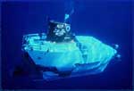 Alvin | 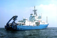 Atlantis |
