Other ID: 2026 Cape Cod National Seashore UxS
Status: Completed
Organization(s): USGS, Woods Hole Coastal and Marine Science Center
Funding Program(s): Aerial Imaging & Mapping (AIM) (LQ000GU1400), Next-Generation Total Water Level and Coastal Change Forecast (WH) (MN00U03)
Principal Investigator(s): Christopher Sherwood
Affiliate Investigator(s): Peter Traykovski (WHOI)
Information Specialist(s): Jin-Si Over
Data Type(s): Imagery: Photo, Location-Elevation: Navigation, Location-Elevation: LIDAR, Sonar: Single Beam
Scientific Purpose/Goals: Data will be used to map the bluff, beach, and nearshore in front of the CoastCam. This will validate the images from the CoastCam and the total water level forecast. Data will also be used to monitor erosion near the NPS stairs and to assess potential loss to gov property.
Vehicle(s):
Start Port/Location: Wellfleet, MA
End Port/Location: Wellfleet, MA
Start Date: 2026-03-10
End Date: 2026-03-19
Equipment Used: Freefly Astro Max, WingtraOne Gen II, Emlid RS3, Aeropoint targets, Wingtra Lidar, Cerulean Sonar S-500 Sounder
Information to be Derived: Elevation profiles, photos for structure-from-motion, lidar data, and single-beam echosounder data.
Summary of Activity and Data Gathered: 3/10/26 Collected RGB photos with Astro Max for SfM. Collected RGB photos and lidar with the Wingtra for SfM and elevation modeling. Emlids were used to collect GPS data. 3/19/26 Bathymetry data was collected with Yellowfin.
Staff: Amit Millo, Jin-Si Over, Sandra Brosnahan
Affiliate Staff:
Notes: Entries for this field activity are based on entries from Field Activity 2024-024-FA.
Entries for this field activity are based on entries from Field Activity 2025-005-FA.
Location:
Marconi Beach, Cape Cod National Seashore
| Boundaries | |||
|---|---|---|---|
| North: 41.90263478 | South: 41.88880919 | West: -69.96879959 | East: -69.95067215 |
Platform(s):
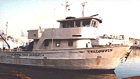 Yellowfin |  on foot |
| Survey Equipment | Survey Info | Data Type(s) | Data Collected |
|---|---|---|---|
| Freefly Astro Max | --- | Video Photo | |
| WingtraOne Gen II | --- | Navigation Photo | |
| Emlid RS3 | --- | Navigation | |
| Aeropoint targets | --- | Navigation Transects Profiles | |
| Wingtra Lidar | --- | Navigation LIDAR | |
| Cerulean Sonar S-500 Sounder | --- | Single Beam |
