Other ID: none
Status: Pending
Organization(s): USGS, Woods Hole Coastal and Marine Science Center
Funding Program(s):
Contact(s): Laura Brothers Information Specialist(s): Laura Brothers Data Type(s): Visual Identification: Ground Truthing, Sampling: Geology Scientific Purpose/Goals: To collect seabed characterization information Vehicle(s): Start Port/Location: Portsmouth, NH End Port/Location: Portsmouth, NH Start Date: 2026-08-24 End Date: 2026-08-30 Equipment Used: SeaBOSS, Alpine Vibracorer Information to be Derived: seafloor images, sediment samples, and vibracores Summary of Activity and Data Gathered: Notes:
Location:
Offshore New Hampshire
| Boundaries | |||
|---|---|---|---|
| North: 43.20517582 | South: 42.87059631 | West: -70.98999046 | East: -69.96459939 |
Platform(s):
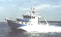 Gulf Challenger |
| Survey Equipment | Survey Info | Data Type(s) | Data Collected |
|---|---|---|---|
| SeaBOSS | --- | Surveys (biological) Experiments (biological) Species ID Photo Video Geology Biology | |
| Alpine Vibracorer | --- | Geology |
