AKA: none
Other ID: A-02-11-MU
Status: Completed
Organization(s):
Funding Program(s):
Principal Investigator(s): Ann Gibbs
Affiliate Investigator(s):
Information Specialist(s): Ann Gibbs
Data Type(s): Imagery: Video, Location-Elevation: Navigation
Scientific Purpose/Goals: Benthic habitat/seafloor characterization using georeferenced underwater video
Vehicle(s):
Start Port/Location: Lahaina, Maui
End Port/Location: Lahaina, Maui
Start Date: 2011-03-17
End Date: 2011-03-24
Equipment Used: Underwatervideo, navigation
Information to be Derived:
Summary of Activity and Data Gathered:
Staff: Ann Gibbs, Gerry Hatcher, Joshua Logan
Affiliate Staff:
Notes: rawdata exists on:/rawdata/2011/A-02-11-MU
Staff information imported from InfoBank
Ann Gibbs
Gerry Hatcher
Josh Logan
Location:
Hawaii
| Boundaries | |||
|---|---|---|---|
| North: 20.96402 | South: 20.78411 | West: -156.701 | East: -156.55765 |
Platform(s):
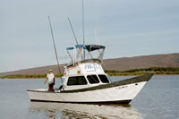
 Alyce C |
Gibbs, A.E., Cochran, S.A., and Tierney, P.W., 2013, Seafloor video footage and still-frame grabs from U.S. Geological Survey cruises in Hawaiian nearshore waters: U.S. Geological Survey Data Series 735, 11 p., http://pubs.usgs.gov/ds/735/.
Heberer, L.N., Alkins, K.A., Storlazzi, C.D., Cochran, S.A., Gibbs, A.E., Sparks, R., Silva, I., Stone, K., Martinez, T., Peralto, C., 2025, Benthic habitat map of the geomorphological structure, biological cover, and geologic zonation of Olowalu reef, Maui: data release, https://doi.org/10.5066/P9ICJ7CF.
Swarzenski, P.W., Storlazzi, C.D., Presto, M.K., Gibbs, A.E., Smith, C.G., Dimova, N.T., Dailer, M.L., and Logan, J.B., 2012, Nearshore morphology, benthic structure, hydrodynamics, and coastal groundwater discharge near Kahekili Beach Park, Maui, Hawaii: U.S. Geological Survey Open-File Report 2012â1166, http://pubs.usgs.gov/of/2012/1166/.
FAN A0211MU has data viewable in the CMGP Video and Photograph Portal. View the data in this application here. See the instructions for working with this application.
| Survey Equipment | Survey Info | Data Type(s) | Data Collected |
|---|---|---|---|
| Underwatervideo | --- | Video | |
| navigation | --- | Navigation | a-02-11-mu.060 Global positioning system (GPS) data a-02-11-mu.060 |