AKA: none
Other ID: A-1-02-SC,A1-02-SC
Status: Completed
Organization(s): USGS, Pacific Coastal and Marine Science Center
Funding Program(s): Southern California Continental Borderland (MU270)
Principal Investigator(s): Michael Fisher, Chris Gutmacher
Affiliate Investigator(s):
Information Specialist(s): Chris Gutmacher
Data Type(s): Location-Elevation: Navigation, Seismics: Air Gun / Water Gun, Seismics: Boomer, Seismics: Sparker, Sonar: Sidescan, Sonar: Single Beam
Scientific Purpose/Goals: 2 part: sidescan survey for Marine Minerals Service near Pts. Arguello and Conception. Geophysical survey to expand mapping of offshore faults in Santa Barbara Channel from Gaviota to Pt. Dume.
Vehicle(s):
Start Port/Location: Redwood City, CA
End Port/Location: Redwood City, CA
Start Date: 2002-06-14
End Date: 2002-06-29
Equipment Used: GPS, Kleinsidescan, airgun, minisparker, Chirp, boomer, 12khz, YoNav, sparker
Information to be Derived: Sidescan mosaic and interpreted locations of natural gas seeps. Fault map and target locations for future cores to determine age of fault movement.
Summary of Activity and Data Gathered: Sidescan survey completed. Geophysical survey hampered by high winds and equipment problems; nonetheless some excellent data were acquired.
Staff: Michael Boyle, Beth Feingold, Chris Gutmacher, Larry Kooker, Kevin O'Toole, Jane Reid, Ray Sliter
Affiliate Staff:
Lori Hibbeler (USGS Menlo Park
CA) - Navigation
Mike Belliveau (Geoforce Consultants
Nova Scotia) - Huntec support
Todd Chandler (Cascadia Research
Olympia
WA) - Mammal observation chief
Randy Lumper (Cascadia Research
Olympia
WA) - Mammal observation
Laura Maycollado (Cascadia Research
Olympia
WA) - Mammal observation
Beth Phillips (Cascadia Research
Olympia
WA) - Mammal observation
Christina Tombach (Cascadia Research
Olympia
WA) - Mammal observation
Ken Robinson (F/V Northwind Inc.
Seattle
WA) - Captain Auriga
Kevin Blakley (F/V Northwind Inc.
Seattle
WA) - First Mate
Jamie Lauritzen (F/V Northwind Inc.
Seattle
WA) - Second Mate
Mike Horton (F/V Northwind Inc.
Seattle
WA) - Chief Engineer
Mike Henderson (F/V Northwind Inc.
Seattle
WA) - Engineer
Modu Ndiaye (not just cook!
F/V Northwind Inc.
Seattle
WA) - Chef
Notes:
Staff information imported from InfoBank
Mike Fisher (USGS Menlo Park, CA) - Chief scientist
Chris Gutmacher (USGS Menlo Park, CA) - Assistant chief scientist
Beth Feingold (USGS Menlo Park, CA) - Navigation
Lori Hibbeler (USGS Menlo Park, CA) - Navigation
Jane Reid (USGS Menlo Park, CA) - Data Acquisition
Ray Sliter (USGS Menlo Park, CA) - Data Acquisition
Kevin O'Toole (USGS Menlo Park, CA) - MT
Mike Boyle (USGS Menlo Park, CA) - ET
Larry Kooker (USGS Menlo Park, CA) - ET
Mike Belliveau (Geoforce Consultants, Nova Scotia) - Huntec support
Todd Chandler (Cascadia Research, Olympia, WA) - Mammal observation chief
Randy Lumper (Cascadia Research, Olympia, WA) - Mammal observation
Laura Maycollado (Cascadia Research, Olympia, WA) - Mammal observation
Beth Phillips (Cascadia Research, Olympia, WA) - Mammal observation
Christina Tombach (Cascadia Research, Olympia, WA) - Mammal observation
Ken Robinson (F/V Northwind Inc., Seattle, WA) - Captain Auriga
Kevin Blakley (F/V Northwind Inc., Seattle, WA) - First Mate
Jamie Lauritzen (F/V Northwind Inc., Seattle, WA) - Second Mate
Mike Horton (F/V Northwind Inc., Seattle, WA) - Chief Engineer
Mike Henderson (F/V Northwind Inc., Seattle, WA) - Engineer
Modu Ndiaye (not just cook!, F/V Northwind Inc., Seattle, WA) - Chef
Location:
Pt. Arguello to Pt. Dume
| Boundaries | |||
|---|---|---|---|
| North: 37.83305 | South: 33.89323 | West: -122.729 | East: -118.87541 |
Platform(s):
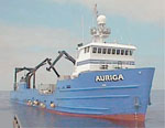 Auriga |
Lorenson, T.D., Hostettler, F.D., Rosenbauer, R.J., Peters, K.E., Kvenvolden, K.A., Dougherty, J.A., Gutmacher, C.E., Wong, F.L., and Normark, W.R., 2009, Natural offshore seepage and related tarball accumulation on the California coastline; Santa Barbara Channel and the southern Santa Maria Basin; source identification and inventory: U.S. Geological Survey Open-File Report 2009-1225, 116 p., http://pubs.usgs.gov/of/2009/1225/.
| Survey Equipment | Survey Info | Data Type(s) | Data Collected |
|---|---|---|---|
| GPS | --- | Navigation | Global positioning system (GPS) data a-1-02-sc.062.info Global positioning system (GPS) data a-1-02-sc.062.nav Global positioning system (GPS) data a-1-02-sc.062.navpt Global positioning system (GPS) data a-1-02-sc.062 (Provisional best file) Best file with nav in ArcInfo E00 format |
| Kleinsidescan | --- | Sidescan | |
| airgun | --- | Air Gun / Water Gun | 410_scag (Provisional best file) |
| minisparker | --- | Sparker | |
| Chirp | --- | Boomer | chirp.pt1.sgy.zip data a-1-02-sc.chirp.pt1.sgy.zip (Provisional best file) chirpchirp.pt2.sgy.zip data a-1-02-sc.chirp.pt2.sgy.zip (Provisional best file) |
| boomer | --- | Boomer | |
| 12khz | --- | Single Beam | |
| YoNav | --- | Navigation | |
| sparker | --- | Sparker |
