AKA: none
Other ID: A-1-03-HW
Status: Completed
Organization(s): USGS, Pacific Coastal and Marine Science Center, USGS, National Mapping Division, Flagstaff
Funding Program(s): Coral Reefs (MU070)
Principal Investigator(s): Pat Chavez
Affiliate Investigator(s):
Information Specialist(s): Miguel Velasco, Ann Gibbs
Data Type(s): Imagery: Photo, Location-Elevation: Navigation, Imagery: Video
Scientific Purpose/Goals: Collect geographically referenced video of coral reefs for bottom type classification.
Vehicle(s):
Start Port/Location: Molokai
End Port/Location: Molokai
Start Date: 2003-02-10
End Date: 2003-02-12
Equipment Used: underwatercamera, GPS, underwatertelevision
Information to be Derived: Bottom type classification
Summary of Activity and Data Gathered: Video, GPS
Staff: Miguel Velasco, Ann Gibbs
Affiliate Staff:
Joe Reich - Ship Captain
Notes:
Staff information imported from InfoBank
Pat Chavez (USGS NMD, Flagstaff) - Chief Scientist
Miguel Velasco (USGS NMD, Flagstaff) - Video collection
Ann Gibbs (USGS CMG, WR) - Video collection
Joe Reich - Ship Captain
Location:
Hawaii
| Boundaries | |||
|---|---|---|---|
| North: 22.25 | South: 18.75 | West: -160.25 | East: -154.25 |
Platform(s):
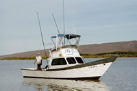
 Alyce C |
FAN A103HW has data viewable in the CMGP Video and Photograph Portal. View the data in this application here. See the instructions for working with this application.
| Survey Equipment | Survey Info | Data Type(s) | Data Collected |
|---|---|---|---|
| underwatercamera | --- | Video Photo | |
| GPS | --- | Navigation | |
| underwatertelevision | --- | Video |