AKA: none
Other ID: A-1-09-PS
Status: Completed
Organization(s): USGS, Pacific Coastal and Marine Science Center
Funding Program(s): Beach and Nearshore Dynamics, influence on eelgrass (Zostera marina) (ZP00AZZ)
Principal Investigator(s): Renee Takesue
Affiliate Investigator(s):
Information Specialist(s): Renee Takesue
Data Type(s): Location-Elevation: Navigation, Time Series: Mooring (physical oceanography)
Scientific Purpose/Goals: Explore relations between turbidity, leaf photosynthetic activity and plant growth
Vehicle(s):
Start Port/Location: Friday Harbor, WA
End Port/Location: Friday Harbor, WA
Start Date: 2009-01-13
End Date: 2009-02-03
Equipment Used: navigation, tripod
Information to be Derived: Time series of turbidity at the top of the eelgrass canopy; plant morphometrics
Summary of Activity and Data Gathered: Turbidity at the top of the canopy and plant growth will be measured over 3 weeks in winter in Picnic Cove, Shaw Island and Shoal Bay, Lopez Island. Related activities: A-1A-09-PS (April 6-7, 2009) A-1B-09-PS (April 27-28, 2009)
Staff: Carrie Craig, Timothy Elfers
Affiliate Staff:
Sandy Wyllie (Measure water column parameters
UW/FHL) - Echeverria
Pema Kitaeff (UW/FHL) - Collect plants
Notes: Tim Elfers: fabrication of tripods (2 weeks), in-field deployment (3 days) Univ. Washington Friday Harbor Laboratories boat Auklet Deploy turbidity sensors, collect eelgrass plants, measure leaf fluorescence.
Staff information imported from InfoBank
Renee Takesue (Boat Tender, USGS/WCMG) - Chief Scientist
Tim Elfers (USGS/WCMG) - Assist tripod deployment
Sandy Wyllie (Measure water column parameters, UW/FHL) - Echeverria
Pema Kitaeff (UW/FHL) - Collect plants
Carrie Craig - Collect plants UW/FHL
Location:
Washington
| Boundaries | |||
|---|---|---|---|
| North: 48.76015 | South: 48.55341 | West: -122.924 | East: -122.87601 |
Platform(s):
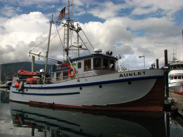 Auklet |
| Survey Equipment | Survey Info | Data Type(s) | Data Collected |
|---|---|---|---|
| navigation | --- | Navigation | Global positioning system (GPS) data a-1-09-ps.060 (Provisional best file) Best file with nav in ArcInfo E00 format a-1-09-ps.zip |
| tripod | --- | Mooring (physical oceanography) |
