AKA: none
Other ID: A-1-11-BI
Status: Completed
Organization(s): USGS, Pacific Coastal and Marine Science Center, University of Hawaii, National Park Service
Funding Program(s): Pacific Coral Reef Geology and Oceanography (ZP00DXN)
Principal Investigator(s): Michael Field, Curt Storlazzi
Affiliate Investigator(s):
Information Specialist(s): Susan Cochran, Joshua Logan, Kathy Presto
Data Type(s): Electro-Magnetic: Resistivity, Imagery: Photo, Location-Elevation: Navigation, Location-Elevation: Transects, Sampling: Geology, Time Series: Mooring (physical oceanography)
Scientific Purpose/Goals: recovery of instruments, collection of field data
Vehicle(s):
Start Port/Location: Kawaihae Harbor, Kawaihae Bay, Hawai`i (Big Island)
End Port/Location: Kawaihae Harbor, Kawaihae Bay, Hawai`i (Big Island)
Start Date: 2011-03-07
End Date: 2011-03-15
Equipment Used: navigation, Push corer, electricalresistivity, camera, instrumentmooring, topographic profiling
Information to be Derived: tides, waves, currents, acoustic backscatter, optical backscatter, water temperature, salinity, sediment grain size, sediment composition, wind speed, wind direction, rainfall, air temperature.
Summary of Activity and Data Gathered:
Staff: Susan Cochran, Timothy Elfers, Michael Field, Joshua Logan, Kathy Presto, Thomas Reiss, Curt Storlazzi, Michael Torresan
Affiliate Staff:
Pete Swarzenski
Notes: Alyce C used for recovering instruments. Also used small NPS boat(s) for bathymetry. Pacific coral reef geology and oceanography, Land-based pollution information collected. Push cores taken by Swarzenski (wading/snorkeling). rawdata exists on: /rawdata/2011/A-1-11-BI/rez_samp rawdata exists on: /rawdata/2011/A-1-11-BI/topo rawdata exists on: /rawdata/2011/A-1-11-BI/meter
Staff information imported from InfoBank
Mike Field
Curt Storlazzi
Josh Logan
Kathy Presto
Susie Cochran
Pete Swarzenski
Tom Reiss
Mike Torresan
Tim Elfers
Location:
Hawai`i (Big Island)
| Boundaries | |||
|---|---|---|---|
| North: 20.5 | South: 18.75 | West: -156.25 | East: -154.75 |
Platform(s):
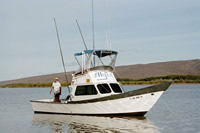
 Alyce C |
Storlazzi, C.D., Field, M.E., Presto, M.K., Swarzenski, P.W., Logan, J.B., Reiss, T.E., Elfers, T.C., Cochran, S.A., Torresan, M.E., and Chezar, H., 2013, Coastal circulation and sediment dynamics in Pelekane and Kawaihae Bays, Hawaiiâmeasurements of waves, current, temperature, salinity, turbidity, and geochronology: November 2010-March 2011: U.S. Geological Survey Open-File Report 2012-1264, 102 p., http://pubs.usgs.gov/of/2012/1264/.
| Survey Equipment | Survey Info | Data Type(s) | Data Collected |
|---|---|---|---|
| navigation | --- | Navigation | Global positioning system (GPS) data a-1-11-bi.060 (Provisional best file) a-1-11-bi.lines Best file with nav in ArcInfo E00 format a-1-11-bi.zip a-1-11-bi.onoff.cores.pushcore |
| Push corer | --- | Surveys (geochemical) Surveys (biological) Biology Geology | |
| electricalresistivity | --- | Resistivity | |
| camera | --- | Photo | |
| instrumentmooring | --- | Geology Mooring (physical oceanography) | |
| topographic profiling | --- | Profiles Transects |