AKA: none
Other ID: A-1-74-NA
Status: Completed
Organization(s): USGS, Pacific Coastal and Marine Science Center
Funding Program(s):
Principal Investigator(s):
Affiliate Investigator(s): J. Heirtzler
Information Specialist(s):
Data Type(s): Imagery: Photo
Scientific Purpose/Goals:
Vehicle(s):
Start Port/Location:
End Port/Location:
Start Date: 1974-06-21
End Date: 1974-08-06
Equipment Used: submersible
Information to be Derived:
Summary of Activity and Data Gathered:
Staff:
Affiliate Staff:
J. Heirtzler
Jim Mooreler
Notes: microfilm of Dive 519 and 520 bottom photos in holdings; metadata added by Carol Reiss from Alvin dive logs
Staff information imported from InfoBank
J. Heirtzler
Jim Mooreler
Location:
Mid Atlantic Ridge
| Boundaries | |||
|---|---|---|---|
| North: 66.75 | South: -4.75 | West: -99.75 | East: 17.75 |
Platform(s):
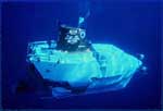 Alvin |
| Survey Equipment | Survey Info | Data Type(s) | Data Collected |
|---|---|---|---|
| submersible | --- | Photo Video Biology Geology |
