AKA: none
Other ID: A-1-90-WF,Dive 2257
Status: Completed
Organization(s):
Funding Program(s):
Principal Investigator(s):
Affiliate Investigator(s): Bob Embley
Information Specialist(s):
Data Type(s): Location-Elevation: Navigation, Sampling: Geology
Scientific Purpose/Goals:
Vehicle(s):
Start Port/Location:
End Port/Location:
Start Date: 1990-08-17
End Date: 1990-09-05
Equipment Used: navigation, grab sampler, submersible
Information to be Derived:
Summary of Activity and Data Gathered:
Staff:
Affiliate Staff:
Notes:
Location:
Southern Juan de Fuca Ridge
| Boundaries | |||
|---|---|---|---|
| North: 50.75 | South: 42.25 | West: -134.75 | East: -122.25 |
Platform(s):
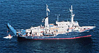 Atlantis II |
| Survey Equipment | Survey Info | Data Type(s) | Data Collected |
|---|---|---|---|
| navigation | --- | Navigation | |
| grab sampler | --- | Surveys (geochemical) Geology | |
| submersible | --- | Photo Video Biology Geology | ALV2266 (Alvin sample massive sulfide) ALV2259-2269 (massive sulfide in holdings) |
