AKA: none
Other ID: A-1-93-GB,CRUISE_173
Status: Completed
Organization(s): Appalachian State University
Funding Program(s): Glacial Marine Sedimentary History (MU121)
Principal Investigator(s):
Affiliate Investigator(s): Ellen Cowan (Appalachian State University), Ross Powell
Information Specialist(s):
Data Type(s): Location-Elevation: Navigation, Sampling: Geology, Seismics: Boomer, Seismics: Sub Bottom Profiler, Sonar: Sidescan, Sonar: Single Beam
Scientific Purpose/Goals: To characterize seismic facies for interpreting past glacier behavior, especially during the last glacial maximum. Glacier Bay is the site of the best documented major marine deglaciation in the world and allows comparison between glacier terminus stability with changing climate and marine conditions. Upper Yakutat Bay contains deposits produced by the surge of the Hubbard Glacier in 1986 and the subsequent outburst flood from Russell Fjord. Historical records of glacier terminus positions provide a datum with which the history of this marine glacial system can be determined from seismic and sedimentary facies.
Vehicle(s):
Start Port/Location:
End Port/Location:
Start Date: 1993-08-17
End Date: 1993-09-03
Equipment Used: Huntec, gravitycore, VanVeengrab, 7khz, 12khz, GPS, pistoncore, sidescansonar
Information to be Derived:
Summary of Activity and Data Gathered:
Staff: Paul Carlson, Dave Hogg, Robert Kayen
Affiliate Staff:
Jinkui Cai (Northern Illinois University) - Postdoc Fellow
Jenifer Clark (Appalachian State University) - Undergraduate Student
Rafael Gutierrez (Appalachian State University) - Undergraduate Student
Paul Jones (Glacier Bay National Park) - Marine Mammal Observer
Christen Nall (Appalachian State University) - Undergraduate Student
Keith Seramur (Appalachian State University) - Adjunct Research Associate
Graham Standen (Geoforce Consultants
Nova Scotia) - Operator Of Huntec
Sarah Zellers (University Of Texas) - Graduate Student
Ross Powell (chief Scientist
Appalachian State University) - Co
Notes: Staff information imported from InfoBank
Paul Carlson (USGS Western Region) - Participating Scientist
Jinkui Cai (Northern Illinois University) - Postdoc Fellow
Jenifer Clark (Appalachian State University) - Undergraduate Student
Rafael Gutierrez (Appalachian State University) - Undergraduate Student
Dave Hogg (USGS Western Region) - Technician
Paul Jones (Glacier Bay National Park) - Marine Mammal Observer
Rob Kayen (USGS Western Region) - Participating Scientist
Christen Nall (Appalachian State University) - Undergraduate Student
Keith Seramur (Appalachian State University) - Adjunct Research Associate
Graham Standen (Geoforce Consultants, Nova Scotia) - Operator Of Huntec
Sarah Zellers (University Of Texas) - Graduate Student
Ellen Cowan (Appalachian State University) - Chief Scientist
Ross Powell (chief Scientist, Appalachian State University) - Co
Location:
Alaska
| Boundaries | |||
|---|---|---|---|
| North: 59.08583 | South: 58.15867 | West: -137.6 | East: -135.89283 |
Platform(s):
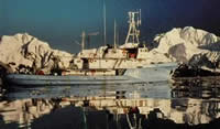 Alpha Helix |
Carlson, P.R., Cowan, E.A., Powell, R.D., and Cai, J., 1999, Growth of a post-Little Ice Age submarine fan, Glacier Bay, Alaska: Geo-Marine Letters, v. 19, pp. 227–236.
Cowan, E.A., Powell, Ross D., Carlson, Paul R., Kayen, Robert E., Cai, Jinkui, Seramur, Keith C., and Zellers, Sarah D., 1994, Cruise report; R/V Alpha Helix Cruise-173 to western Prince William Sound, Yakutat Bay, and Glacier Bay National Park, northeastern Gulf of Alaska, August 17-September 3, 1993: U.S. Geological Survey Open-File Report 94-0258, 176 p.
| Survey Equipment | Survey Info | Data Type(s) | Data Collected |
|---|---|---|---|
| Huntec | --- | Boomer | huntec (data on FAD) |
| gravitycore | --- | Geology | a-1-93-gb.onoff.cores.gravitycore |
| VanVeengrab | --- | Geology | a-1-93-gb.onoff.grabs.vanveengrab |
| 7khz | --- | Sub Bottom Profiler | |
| 12khz | --- | Single Beam | A-1-93-PW_197979_bathy12 (scanned microfilm) A-1-93-GB_197980_bathy12 (scanned microfilm) |
| GPS | --- | Navigation | Best file with nav in ArcInfo E00 format a-1-93-gb.zip Integrated navigation (SINS) data a-1-93-gb.053 Integrated navigation (SINS) data a-1-93-gb.050 Integrated navigation (SINS) data a-1-93-gb.050_degree |
| pistoncore | --- | Geology | |
| sidescansonar | --- | Sidescan |
