AKA: none
Other ID: A-1-98-HW,OA-1-98-HW
Status: Completed
Organization(s): USGS, Pacific Coastal and Marine Science Center
Funding Program(s): Pacific Seafloor Mapping Project (ZP000LD)
Principal Investigator(s): Jim Gardner
Affiliate Investigator(s):
Information Specialist(s): Peter Dartnell
Data Type(s): Location-Elevation: Navigation, Sonar: Multibeam, Sonar: Sidescan
Scientific Purpose/Goals: Map areas around the Hawaiian Islands (Kauai, Oahu, Maui, Hawaii) to support a variety of projects, including marine disposal site studies, coral reef studies, and Marine Sanctuary studies.
Vehicle(s):
Start Port/Location:
End Port/Location:
Start Date: 1998-02-04
End Date: 1998-02-27
Equipment Used: GPS, integratednavigation, multibeam, sidescansonar
Information to be Derived: Bathymetry, backscatter, slope, sediment volumes, interpreted geology, etc
Summary of Activity and Data Gathered: Completed survey and processed bathymetry and backscatter data off specific areas of the Hawaiian Islands, including Kauai Oahu, Hawaii, and the Humpback Whale Marine Sanctuary between Molokai, Maui, Lanai, and Kahoolawe.
Staff:
Affiliate Staff:
Art Kleiner (C&C Technologies) - Party Chief
Notes: For raw and intermediate data sets, contact Rani Nandiwada
Staff information imported from InfoBank
Jim Gardner (USGS Western Region) - Chief Scientist
Art Kleiner (C&C Technologies) - Party Chief
Location:
Hawaii
| Boundaries | |||
|---|---|---|---|
| North: 22.03334 | South: 19.58333 | West: -159.7667 | East: -154.8 |
Platform(s):
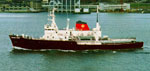 Ocean Alert |
Torresan, M.E. and G., James V.,, 2000, Acoustic Mapping of the Regional Seafloor Geology in and Around Hawaiian Ocean Dredged-Material Disposal Sites: U.S. Geological Survey Open-File Report 00-124, http://pubs.usgs.gov/of/2000/0124/.
| Survey Equipment | Survey Info | Data Type(s) | Data Collected |
|---|---|---|---|
| GPS | --- | Navigation | survey information (GPS) |
| integratednavigation | --- | Navigation | Integrated navigation (SINS) data a-1-98-hw.050 (Provisional best file) survey information (integrated navigation) |
| multibeam | --- | Multibeam | |
| sidescansonar | --- | Sidescan |
