AKA: none
Other ID: A-2-02-HW
Status: Completed
Organization(s): USGS, Pacific Coastal and Marine Science Center
Funding Program(s): Coral Reefs (MU070)
Principal Investigator(s): Bruce Richmond, Ann Gibbs
Affiliate Investigator(s):
Information Specialist(s): Pat Chavez, Eric Grossman, Gerry Hatcher, Henry Chezar
Data Type(s): Imagery: Video, Location-Elevation: Navigation, Environmental Data: Temperature
Scientific Purpose/Goals: Collect underwater video of the sea floor both to characterize substrate type and benthic habitat distribution and to ground-truth recently acquired data including bathymetric (SHOALS) lidar, side-scan sonar, seismic reflection, and surface texture and grain size
Vehicle(s):
Start Port/Location: Oahu
End Port/Location: Molokai
Start Date: 2002-06-24
End Date: 2002-07-11
Equipment Used: underwatertelevision, GPS, temperature
Information to be Derived:
Summary of Activity and Data Gathered: Video, GPS, water temperature, salinity
Staff: Eric Grossman, Gerry Hatcher, Pat Chavez, Henry Chezar
Affiliate Staff:
Joe Reich - Ship Captain
Notes: Oahu - Chief: Eric Grossman; Crew: Hank Chezar, Eric Grossman, Gerry Hatcher; Dates: 25-Jun-02 to 28-Jun-02; Tapes 1-9(9); Lines: OVHM 1-14. Molokai - Chief: Bruce Richmond; Crew: Hank Chezar, Ann Gibbs, Eric Grossman, Gerry Hatcher; Dates: 30-Jun-02 to 02-Jul-02; Tapes 10-16(7); Lines: MVM 1-16. Maui - Chief: Ann Gibbs; Crew: Eric Grossman, Bruce Richmond; Dates: 03-Jul-02 to 06-Jul-02; Tapes 17-27(11); Lines: VVM 1-30. Molokai (pc_Molokai) - Chief: Pat Chavez; Crew: Ann Gibbs, Will Smith; Dates: 08-Jul-02 to 11-Jul-02; Tapes 28-37(10); Points: 1-365. MVM = Molokai Video Mapping VCAL = Maui Calibration VVM = Maui Video Mapping VMN = Maui Nui OVM = Oahu Video Mapping
Staff information imported from InfoBank
Bruce Richmond (USGS CMG WR) - Chief Scientist
Ann Gibbs (USGS CMG WR) - Chief Scientist
Hank Chezar (USGS CMG WR) - Video Camera Sled
Eric Grossman (USGS CMG WR) - Geologist
Gerry Hatcher (USGS CMG WR) - Gis Applications
Pat Chavez (USGS) - Drop Camera
Joe Reich - Ship Captain
Location:
Maui
| Boundaries | |||
|---|---|---|---|
| North: 21.28844 | South: 20.57563 | West: -157.8678 | East: -156.41233 |
Platform(s):
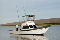
 Alyce C |
Gibbs, A.E., Cochran, S.A., and Tierney, P.W., 2013, Seafloor video footage and still-frame grabs from U.S. Geological Survey cruises in Hawaiian nearshore waters: U.S. Geological Survey Data Series 735, 11 p., http://pubs.usgs.gov/ds/735/.
FAN A202HW has data viewable in the CMGP Video and Photograph Portal. View the data in this application here. See the instructions for working with this application.
| Survey Equipment | Survey Info | Data Type(s) | Data Collected |
|---|---|---|---|
| underwatertelevision | --- | Video | Global positioning system (GPS) data a-2-02-hw.061 Global positioning system (GPS) data a-2-02-hw.062 (Provisional best file) |
| GPS | --- | Navigation | survey information (GPS nav) |
| temperature | --- | Temperature |