AKA: none
Other ID: A-2-10-OA, A-02-10-OA, A0210OA
Status: Completed
Organization(s): USGS, Pacific Coastal and Marine Science Center
Funding Program(s): Coral Reefs (Pacific) (MU071)
Principal Investigator(s): Curt Storlazzi
Affiliate Investigator(s):
Information Specialist(s): Joshua Logan
Data Type(s): Imagery: Photo, Imagery: Video, Location-Elevation: Navigation, Time Series: Mooring (physical oceanography)
Scientific Purpose/Goals: investigate hydrography and coral spawning in Maunalua Bay
Vehicle(s):
Start Port/Location: Ala Wai Yacht Harbor
End Port/Location: Ala Wai Yacht Harbor
Start Date: 2010-06-07
End Date: 2010-06-18
Equipment Used: Remotely Operated Vehicle, navigation, instrumentmooring, video, imagery
Information to be Derived: tide, wave height, wave period, wave direction, current speed, current direction, acoustic backscatter, optical backscatter, temperature, salinity, turbidity, light transmission, chlorophyll, wind speed, wind direction, rainfall,larval density, larval transport pathway
Summary of Activity and Data Gathered:
Staff: Joshua Logan, Greg Piniak, Kathy Presto, Thomas Reiss, Curt Storlazzi, Renee Takesue
Affiliate Staff:
Pete dal Ferro (diver
USGS) - mechanical technician
Robert Richmond (UH) - biologist
Shay Viehman (diver
NOAA
CCFHR) - biologist
Cheryl Woodley (
NOAA
CCEHBR) - biologist
Notes: WCP Water column profiler (Seabird profiler 19+) WS is a weather station onshore. Instruments were deployed during this activity.
Staff information imported from InfoBank
Curt Storlazzi (diver, USGS) - chief scientist
Kathy Presto (diver, USGS) - oceanographer
Josh Logan (diver, USGS) - geographer
Tom Reiss (diver, USGS) - geographer
Pete dal Ferro (diver, USGS) - mechanical technician
Renee Takesue (USGS) - research geochemist
Cheryl Hapke (USGS) - research geologist
Robert Richmond (UH) - biologist
Greg Piniak (diver, NOAA, CCFHR) - biologist
Shay Viehman (diver, NOAA, CCFHR) - biologist
Cheryl Woodley (, NOAA, CCEHBR) - biologist
Location:
HI
| Boundaries | |||
|---|---|---|---|
| North: 21.2877 | South: 21.2449 | West: -157.799 | East: -157.71904 |
Platform(s):
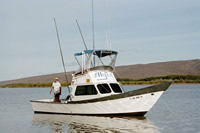
 Alyce C |
Presto, M.K., Storlazzi, C.D., Logan, J.B., Reiss, T.E., and Rosenberger, K.J., 2012, Coastal Circulation and Potential Coral-larval Dispersal in Maunalua Bay, OÊ»ahu, HawaiiâMeasurements of Waves, Currents, Temperature, and Salinity, JuneâSeptember 2010: U.S. Geological Survey Open-File Report 2012-1040, 67 p., http://pubs.usgs.gov/of/2012/1040/.
| Survey Equipment | Survey Info | Data Type(s) | Data Collected |
|---|---|---|---|
| Remotely Operated Vehicle | --- | Photo Video Biology Chemistry Geology | Drifters-061210 (GPS plot of drifter ) Drifters-061310 (GPS plot of drifters) Drifters-061410 (GPS plot of drifters) |
| navigation | --- | Navigation | Global positioning system (GPS) data a-2-10-oa.060 (Provisional best file) Lat/Long/UTM/State Plane data a-2-10-oa.650 (Provisional best file) |
| instrumentmooring | --- | Geology Mooring (physical oceanography) | survey information (mooring location) |
| video | --- | Video | |
| imagery | --- | Photo Video |