AKA: none
Other ID: ACAD87-2,LG1,87023
Status: Completed
Organization(s): USGS, St. Petersburg Coastal and Marine Science Center, USGS, Woods Hole Coastal and Marine Science Center, Louisiana Geological Survey
Funding Program(s): Coastal Erosion (MU052), Coastal Change Hazards (MU051)
Principal Investigator(s): Jack Kindinger, John Suter
Affiliate Investigator(s):
Information Specialist(s): PARTNER
Data Type(s): Seismics: Boomer, Seismics: Sub Bottom Profiler, Location-Elevation: Navigation
Scientific Purpose/Goals: High-resolution seismic survey nearshore and inner shelf of Louisiana, Mississippi and western Alabama east of the Mississippi River delta. Major emphasis is Chandeleur Islands region, LA.
Vehicle(s):
Start Port/Location: Biloxi, LA
End Port/Location: Biloxi, LA
Start Date: 1987-06-14
End Date: 1987-06-26
Equipment Used: Geopulse, 3.5khz, navigation
Information to be Derived: Shoreline Erosion; Morphology.
Summary of Activity and Data Gathered: 1640 km continuous data. High resolution seismics: Leg1: 600km; Leg2: 440km; Leg3: 600km.
Staff: Kenneth F. Parolski
Affiliate Staff:
Wayne Simoneaux - LUMCON
Shea Penland (22
LGS) - June 20
Randolph McBride (22
LGS) - June 20
Steve Anderson (26
LGS) - June 23
Ron Boyd (19
Dalhousie Univ) - June 14
Notes:
Staff information imported from InfoBank
Jack Kindinger (USGS St. Petersburg) - Chief Scientist
John Suter (June 14, 19, LGS) - Chief Scientist
Ken Parolski - USGS Woods Hole
Wayne Simoneaux - LUMCON
Shea Penland (22, LGS) - June 20
Randolph McBride (22, LGS) - June 20
Steve Anderson (26, LGS) - June 23
Ron Boyd (19, Dalhousie Univ) - June 14
Non USGS data manager = Jeff Williams
Location:
North Atlantic
| Boundaries | |||
|---|---|---|---|
| North: 30.25 | South: 29 | West: -89.3 | East: -88 |
Platform(s):
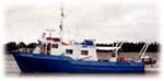 Acadiana |
| Survey Equipment | Survey Info | Data Type(s) | Data Collected |
|---|---|---|---|
| Geopulse | --- | Boomer | |
| 3.5khz | --- | Sub Bottom Profiler | |
| navigation | --- | Navigation |
