AKA: A-2-78-AT
Other ID: none
Status: Completed
Organization(s): USGS, Pacific Coastal and Marine Science Center
Funding Program(s):
Principal Investigator(s):
Affiliate Investigator(s):
Information Specialist(s):
Data Type(s): Sonar: Single Beam
Scientific Purpose/Goals:
Vehicle(s): None
Start Port/Location:
End Port/Location:
Start Date: 1978-06-03
End Date: 1978-06-14
Equipment Used: Fathometer
Information to be Derived:
Summary of Activity and Data Gathered: info from scanned microfilm
Staff:
Affiliate Staff:
Notes:
Location:
Mid Atlantic
| Boundaries | |||
|---|---|---|---|
| North: 49.06474935 | South: 20.27360342 | West: -52.55859375 | East: -18.37890625 |
Platform(s):
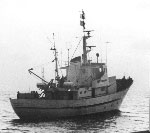 Annandale |
| Survey Equipment | Survey Info | Data Type(s) | Data Collected |
|---|---|---|---|
| Fathometer | --- | Single Beam |
