AKA: none
Other ID: A-2-86-BS
Status: Completed
Organization(s): USGS, Pacific Coastal and Marine Science Center, University of Alaska
Funding Program(s):
Principal Investigator(s):
Affiliate Investigator(s):
Information Specialist(s):
Data Type(s): Environmental Data: CTD, Sonar: Sidescan, Location-Elevation: Navigation
Scientific Purpose/Goals: Study disturbances to substrate and erosion by gray whale, walrus, and ice gouge.
Vehicle(s):
Start Port/Location:
End Port/Location:
Start Date: 1986-06-06
End Date: 1986-06-23
Equipment Used: CTD, sidescansonar, LoranC
Information to be Derived:
Summary of Activity and Data Gathered:
Staff: L. Cooper, A. Daubin, John Barber, S. Dubenhoffer
Affiliate Staff:
Kaj Henrikson - Unspecified
M. Silberstein - Unspecified
D. Arnold - Unspecified
L. Lowry - Unspecified
K. Schaffer - Unspecified
B. Stewart - Unspecified
B. Tershy - Unspecified
J. Schoenherr - Unspecified
J. Heine (Unspecified)
Notes: A flume was used.
Staff information imported from InfoBank
Kaj Henrikson - Unspecified
L. Cooper - Unspecified
M. Silberstein - Unspecified
A. Daubin - Unspecified
John Barber (USGS Western Region) - Unspecified
D. Arnold - Unspecified
L. Lowry - Unspecified
K. Schaffer - Unspecified
B. Stewart - Unspecified
B. Tershy - Unspecified
J. Schoenherr - Unspecified
J. Heine (Unspecified)
S. Dubenhoffer - Unspecified
Location:
St. Matthew Island
| Boundaries | |||
|---|---|---|---|
| North: 65.75 | South: 50.25 | West: 160.25 | East: -155.25 |
Platform(s):
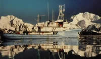 Alpha Helix |
| Survey Equipment | Survey Info | Data Type(s) | Data Collected |
|---|---|---|---|
| CTD | --- | Surveys (geochemical) Experiments (geochemical) CTD | |
| sidescansonar | --- | Sidescan | |
| LoranC | --- | Navigation |
