AKA: none
Other ID: A-3-10-OA
Status: Completed
Organization(s): USGS, Pacific Coastal and Marine Science Center
Funding Program(s): Coral Reefs (Pacific) (MU071)
Principal Investigator(s): Curt Storlazzi
Affiliate Investigator(s):
Information Specialist(s): Joshua Logan
Data Type(s): Location-Elevation: Navigation, Time Series: Mooring (physical oceanography)
Scientific Purpose/Goals: understand the current patterns and water column properties during coral larval spawning season
Vehicle(s):
Start Port/Location: Ala Wai Harbor
End Port/Location: Ala Wai Harbor
Start Date: 2010-09-13
End Date: 2010-09-14
Equipment Used: navigation, instrumentmooring
Information to be Derived: tides, waves, currents, acoustic backscatter, water temperature, salinity, wind speed, wind direction, rainfall, air temperature
Summary of Activity and Data Gathered:
Staff: Timothy Elfers, Joshua Logan, Kathy Presto, Curt Storlazzi
Affiliate Staff:
Jamie Grover (USGS) - mechanical technician
Notes: WS is a weather station onshore. Instruments were recovered on this activity.
Staff information imported from InfoBank
Curt Storlazzi (USGS) - chief scientist
Josh Logan (USGS) - physical scientist
Kathy Presto (USGS) - oceanographer
Tim Elfers (USGS) - mechanical technician
Jamie Grover (USGS) - mechanical technician
Location:
Hawaii
| Boundaries | |||
|---|---|---|---|
| North: 21.2877 | South: 21.2449 | West: -157.799 | East: -157.71904 |
Platform(s):
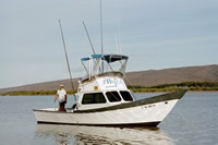
 Alyce C |
Presto, M.K., Storlazzi, C.D., Logan, J.B., Reiss, T.E., and Rosenberger, K.J., 2012, Coastal Circulation and Potential Coral-larval Dispersal in Maunalua Bay, OÊ»ahu, HawaiiâMeasurements of Waves, Currents, Temperature, and Salinity, JuneâSeptember 2010: U.S. Geological Survey Open-File Report 2012-1040, 67 p., http://pubs.usgs.gov/of/2012/1040/.
| Survey Equipment | Survey Info | Data Type(s) | Data Collected |
|---|---|---|---|
| navigation | --- | Navigation | Integrated navigation (SINS) data a-3-10-oa.050 Global positioning system (GPS) data a-3-10-oa.060 (Provisional best file) |
| instrumentmooring | --- | Geology Mooring (physical oceanography) | mooring information |