AKA: none
Other ID: A-3-98-SC,OA-1-98-SC
Status: Completed
Organization(s): USGS, Pacific Coastal and Marine Science Center
Funding Program(s): Pacific Seafloor Mapping Project (ZP000LD)
Principal Investigator(s): Jim Gardner
Affiliate Investigator(s):
Information Specialist(s): Peter Dartnell
Data Type(s): Location-Elevation: Navigation, Sampling: Geology, Sonar: Multibeam, Sonar: Sidescan
Scientific Purpose/Goals: Map San Diego and Los Angeles Margins to support marine disposal site studies, and USGS projects studying marine pollution and geohazards along the Los Angeles Margin.
Vehicle(s):
Start Port/Location:
End Port/Location:
Start Date: 1998-03-26
End Date: 1998-04-11
Equipment Used: clamshellgrab, GPS, integratednavigation, multibeam, sidescansonar
Information to be Derived: Bathymetry, backscatter, slope, sediment volumes, interpreted geology, etc
Summary of Activity and Data Gathered: Completed survey and processed bathymetry and backscatter data of San Diego and Los Angeles Margins.
Staff:
Affiliate Staff:
Art Kleiner (C&C Technologies) - Party Chief
Notes: For raw and intermediate data sets, contact Rani Nandiwada
Staff information imported from InfoBank
Jim Gardner (USGS Western Region) - Chief Scientist
Art Kleiner (C&C Technologies) - Party Chief
Location:
California
| Boundaries | |||
|---|---|---|---|
| North: 34 | South: 32.5 | West: -119 | East: -117 |
Platform(s):
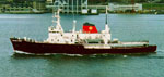 Ocean Alert |
Dartnell, P., Gardner, J.V., Mayer, L.A., and Hughes-Clarke, J.E., 2004, Los Angeles and San Diego Margin High-Resolution Multibeam Bathymetry and Backscatter Data: U.S. Geological Survey Open-File Report 2004-1221, https://doi.org/10.3133/ofr20041221.
Dartnell, P., Roland, E.C., Raineault, N.A., Castillo, C.M., Conrad, J.E., Kane, R.R., Brothers, D.S., Kluesner, J.W., and Walton, M.A.L., 2017, Multibeam bathymetry and acoustic-backscatter data collected in 2016 in Catalina Basin, southern California and merged multibeam bathymetry datasets of the northern portion of the Southern California Continental Borderland: U.S. Geological Survey data release, https://doi.org/10.5066/F7DV1H3W.
Gardner, J.V., 2006, National Seafloor Mapping and Benthic Habitat Studies, Los Angeles, 2006: U. S. Geological Survey Web Page, https://walrus.wr.usgs.gov/pacmaps/la-index.html.
Gardner, J.V., 2006, National Seafloor Mapping and Benthic Habitat Studies, San Diego, 2006: U. S. Geological Survey Web Page, https://walrus.wr.usgs.gov/pacmaps/sd-index.html.
Gardner, J.V., Mayer, L.A., 1998, Cruise report: RV Ocean Alert Cruise A2-98-SC: mapping the southern California continental margin; March 26 through April 11, 1998; San Diego to Long Beach, California: U.S. Geological Survey Open-File Report 98-475, http://pubs.er.usgs.gov/publication/ofr98475.
| Survey Equipment | Survey Info | Data Type(s) | Data Collected |
|---|---|---|---|
| clamshellgrab | --- | Geology | |
| GPS | --- | Navigation | |
| integratednavigation | --- | Navigation | |
| multibeam | --- | Multibeam | |
| sidescansonar | --- | Sidescan |
