AKA: none
Other ID: A-4-02-HW, A402HW
Status: Completed
Organization(s): USGS, Pacific Coastal and Marine Science Center
Funding Program(s): Coral Reefs (MU070)
Principal Investigator(s): Michael Field
Affiliate Investigator(s):
Information Specialist(s): Joshua Logan, Curt Storlazzi
Data Type(s): Environmental Data: Conductivity, Environmental Data: Current, Environmental Data: Temperature, Environmental Data: Turbidity, Environmental Data: Wave, Location-Elevation: Navigation, Time Series: Mooring (physical oceanography)
Scientific Purpose/Goals: Collect in situ measurements of currents, waves and suspended sediment in coral reef environments using tripod mounted instrument packages to assist in determining physical constraints on coral distribution.
Vehicle(s):
Start Port/Location: Lahaina, Maui
End Port/Location: Lahaina, Maui
Start Date: 2002-11-13
End Date: 2002-11-19
Equipment Used: ADP, opticalbackscattersensor, wavepressure, ADV, CTmeter, navigation, tripod
Information to be Derived: Current speed and direction, suspended sediment concentration, salinity, wave height and period.
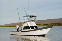
Summary of Activity and Data Gathered: Maui instrument tripod and mini-probe will be recovered from location using the vessel Alyce C. Data from the previous deployment will be downloaded and the instruments will be refurbished at the Maui Ocean Center. The instruments will be redeployed at the same locations for further measurements.
Staff: Susan Cochran, Joshua Logan, Curt Storlazzi, Eric Thompson
Affiliate Staff:
Joe Reich - Boat Captain
Notes: Staff information imported from InfoBank
Mike Field (USGS CMG WR) - Chief Scientist
Curt Storlazzi (USGS CMG WR) - Oceanographer/Geologist
Josh Logan (USGS CMG WR) - GIS Specialist
Susie Cochran (USGS CMG WR) - Project Coordinator
Eric Thompson (USGS CMG WR/UCSC) - Project Intern
Joe Reich - Boat Captain
Location:
Hawaii
| Boundaries | |||
|---|---|---|---|
| North: 20.98252 | South: 20.98249 | West: -156.681 | East: -156.67782 |
Platform(s):
 Alyce C |
| Survey Equipment | Survey Info | Data Type(s) | Data Collected |
|---|---|---|---|
| ADP | --- | Current | |
| opticalbackscattersensor | --- | Turbidity | |
| wavepressure | --- | Wave | |
| ADV | --- | Current | |
| CTmeter | --- | Conductivity Temperature | |
| navigation | --- | Navigation | Global positioning system (GPS) data a-4-02-hw.060 (Provisional best file) |
| tripod | --- | Mooring (physical oceanography) |