AKA: none
Other ID: A-4-98-MB,A4-98-MB
Status: Completed
Organization(s): USGS, Pacific Coastal and Marine Science Center
Funding Program(s): Monterey Bay National Marine Sanctuary (MU182)
Principal Investigator(s): Steve Eittreim, Norman Maher, Andy Stevenson
Affiliate Investigator(s): Norm Maher
Information Specialist(s):
Data Type(s): Location-Elevation: Navigation, Sonar: Multibeam
Scientific Purpose/Goals:
Vehicle(s):
Start Port/Location:
End Port/Location:
Start Date: 1998-01-01
End Date: 1998-01-01
Equipment Used: navigation, multibeam
Information to be Derived:
Summary of Activity and Data Gathered:
Staff:
Affiliate Staff:
Notes: Associated activities: M-1-93-MB J-1-94-MB J-2-95-MB J-6-95-MB M-2-95-MB P-1-95-MB P-3-95-MB R-1-95-MB M-1-96-MB J-1-97-MB J-3-97-MB A-4-98-MB J-3-98-MB J-4-98-MB
Staff information imported from InfoBank
Steve Eittriem (USGS Western Region) - Chief Scientist
Andy Stevenson (USGS Western Region) - Chief Scientist
Norman Maher (MBARI) - Chief Scientist
Location:
CA
| Boundaries | |||
|---|---|---|---|
| North: 36.7844 | South: 36.23254 | West: -122.132 | East: -121.82365 |
Platform(s):
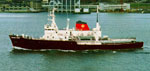 Ocean Alert |
Eittreim, S.L., and Noble, M., 2002, Seafloor geology and natural environment of the Monterey Bay National Marine Sanctuary: Marine Geology, v. 181 no. 1-3, pp. 1–2, doi: 10.1016/S0025-3227(01)00258-4.
Wong, F., and Eittreim, S., 2001, Continental Shelf GIS for the Monterey Bay National Marine Sanctuary: U.S. Geological Survey Open-File Report 01-179, http://pubs.usgs.gov/of/2001/0179/.
| Survey Equipment | Survey Info | Data Type(s) | Data Collected |
|---|---|---|---|
| navigation | --- | Navigation | Integrated navigation (SINS) data a-4-98-mb.051 (Provisional best file) |
| multibeam | --- | Multibeam |
