AKA: none
Other ID: A-5-10-BI, A0510BI, A-05-10-BI
Status: Completed
Organization(s): USGS, Pacific Coastal and Marine Science Center
Funding Program(s): Coral Reefs (Pacific) (MU071)
Principal Investigator(s): Michael Field, Curt Storlazzi
Affiliate Investigator(s):
Information Specialist(s): Joshua Logan
Data Type(s): Environmental Data: Current, Imagery: Photo, Imagery: Video, Location-Elevation: Navigation, Time Series: Mooring (physical oceanography), Sonar: Sidescan
Scientific Purpose/Goals: understanding the fate and impact of sediment on coral reefs
Vehicle(s):
Start Port/Location: Kawaiihae Harbor
End Port/Location: Kawaiihae Harbor
Start Date: 2010-11-01
End Date: 2010-11-09
Equipment Used: navigation, instrumentmooring, video camera, currentdrifter, underwatercamera, sidescansonar
Information to be Derived: tides, waves, currents, acoustic backscatter, optical backscatter, water temperature, salinity, sediment grain size, sediment composition, wind speed, wind direction, rainfall, air temperature
Summary of Activity and Data Gathered:
Staff: Henry Chezar, Timothy Elfers, Joshua Logan, Kathy Presto, Thomas Reiss, Curt Storlazzi
Affiliate Staff:
Notes: Data exists on Makai/ots/Hawaii/Hawaii
Staff information imported from InfoBank
Mike Field (USGS) - Chief scientist
Curt Storlazzi (USGS) - chief scientist
Josh Logan (USGS) - physical scientist
Kathy Presto (USGS) - oceanographer
Tom Reiss (USGS) - oceanographer
Hank Chezar (USGS) - photographic technician
Tim Elfers (USGS) - mechanical technician
Location:
Hawaii
| Boundaries | |||
|---|---|---|---|
| North: 20.08017 | South: 19.94379 | West: -155.873 | East: -155.82054 |
Platform(s):
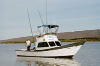
 Alyce C |
Storlazzi, C.D., Field, M.E., Presto, M.K., Swarzenski, P.W., Logan, J.B., Reiss, T.E., Elfers, T.C., Cochran, S.A., Torresan, M.E., and Chezar, H., 2013, Coastal circulation and sediment dynamics in Pelekane and Kawaihae Bays, Hawaiiâmeasurements of waves, current, temperature, salinity, turbidity, and geochronology: November 2010-March 2011: U.S. Geological Survey Open-File Report 2012-1264, 102 p., http://pubs.usgs.gov/of/2012/1264/.
| Survey Equipment | Survey Info | Data Type(s) | Data Collected |
|---|---|---|---|
| navigation | --- | Navigation | Lat/Long/UTM/State Plane data a-5-10-bi.650 (Provisional best file) |
| instrumentmooring | --- | Geology Mooring (physical oceanography) | |
| video camera | --- | Video | |
| currentdrifter | --- | Current | |
| underwatercamera | --- | Video Photo | |
| sidescansonar | --- | Sidescan |