AKA: none
Other ID: A-7-03-HW
Status: Completed
Organization(s): USGS, Pacific Coastal and Marine Science Center, Stanford University
Funding Program(s): Coral Reefs (MU070)
Principal Investigator(s): Michael Field
Affiliate Investigator(s):
Information Specialist(s): Eric Grossman, Ann Gibbs
Data Type(s): Environmental Data: CTD, Environmental Data: Turbidity, Imagery: Video, Sampling: Chemistry
Scientific Purpose/Goals: Map and sample groundwater discharge into nearshore zone; map suspended sediment concentration and grain size in water column; map benthic cover.
Vehicle(s):
Start Port/Location: Lahaina, Maui
End Port/Location: Lahaina, Maui
Start Date: 2003-07-05
End Date: 2003-07-09
Equipment Used: CTD, opticalbackscattersensor, underwatertelevision, sizedistributionsensor, Niskenbottle
Information to be Derived: Conductivity, temperature salinity, optical backscatter, sediment concentration and 32 sediment-grain size classes of suspended sediments, pH, and chlorophyll in the water column. Scaled video of substrate type, coral cover, and benthic habitats. Ra isotopes of nearshore water to derive mixing models and quantify terrestrial groundwater discharge into near shore. _14C and _13C of near shore waters to quantify terrestrial groundwater discharge into near shore. DIC concentration of near shore water to quantify carbonate chemistry. DOC and POC of near shore water to assess local carbon budget. Nutrient concentration (nitrate, nitrite, ammonium, phosphate) of near shore water to characterize nutrient and calculate flux.
Summary of Activity and Data Gathered:
Staff: Eric Grossman, Jodi Harney, Ann Gibbs
Affiliate Staff:
Adina Paytan (Stanford University) - Collect water samples
Joseph Street (Stanford University) - Collect water samples
Notes:
Staff information imported from InfoBank
Eric Grossman (acquire CTD/VIDEOdata and collect water samples, USGS WR CMG) - Coordinate and conduct mapping and sampling
Jodi Harney (USGS WR CMG) - Acquire LISST data
Ann Gibbs (USGS WR CMG) - Acquire navigation data
Adina Paytan (Stanford University) - Collect water samples
Joseph Street (Stanford University) - Collect water samples
Mike Field (USGS WR CMG) - Chief Scientist
Location:
Hawaii
| Boundaries | |||
|---|---|---|---|
| North: 22.25 | South: 18.75 | West: -160.25 | East: -154.25 |
Platform(s):
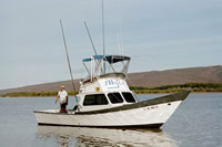
 Alyce C |
FAN A703HW has data viewable in the CMGP Video and Photograph Portal. View the data in this application here. See the instructions for working with this application.
| Survey Equipment | Survey Info | Data Type(s) | Data Collected |
|---|---|---|---|
| CTD | --- | Surveys (geochemical) Experiments (geochemical) CTD | |
| opticalbackscattersensor | --- | Turbidity | |
| underwatertelevision | --- | Video | |
| sizedistributionsensor | --- | Turbidity | |
| Niskenbottle | --- | Chemistry |